
National Emergency Services Museum
National Emergency Services Museum is a museum in Sheffield. Look also at Sheffield Cathedral, 300 m away, first of 49 more within 15 km. It has articles in 2 Wikipedias.
Museum in Sheffield
Inside Sheffield
National Emergency Services Museum is inside Sheffield’s built-up area, with 26 more places to visit within 5 km. Towns near it ↓
Written from OpenStreetMap, Wikidata, the ONS built-up areas and Met Office 1991–2020 averages.
Month by month in Sheffield
The warmest stretch in Sheffield is June to September, at 18–21°C in the afternoon.
National Emergency Services Museum
Museum in Sheffield, England.
In Sheffield, inside the town’s built-up area.
- Type
- Museum
- Wikipedias
- Covered in 2 languages
- Town
- in Sheffield
- Official site
- visitnesm.org.uk
The practical side
- EntryA fee is charged
The map
The places near National Emergency Services Museum are numbered on the map in the order below.
© OpenStreetMap contributors · The dashed line is Sheffield’s built-up area. · ONS built-up area 2022
Towns a short way from National Emergency Services Museum
All of these towns include it on their pages.
Sheffield
Other places close by
Choose from 49 places within 15 km, such as 3 museums, 2 cathedrals and a castle.
 CathedralSheffield Cathedral300 m away2
 CathedralCathedral Church of St Marie500 m away3
 CastleSheffield Castle500 m away4
 MuseumKelham Island Museum500 m away5
 MuseumWeston Park Museum1.5 km away6
 Art galleryGraves Gallery700 m away7
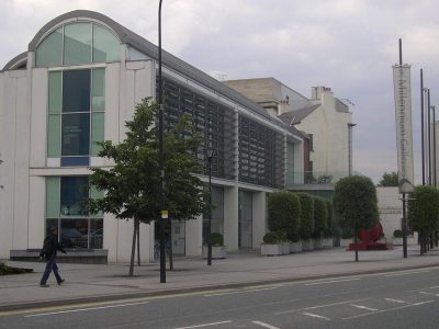 MuseumMillennium Gallery700 m away8
 GardenSheffield Botanical Gardens2.3 km away
Within 15 km, close and well known first. Numbers match the map.
National Emergency Services Museum: what to know
Where is National Emergency Services Museum?
National Emergency Services Museum is in Sheffield, South Yorkshire, inside the town’s built-up area.
What is National Emergency Services Museum?
Museum in Sheffield, England.
When is the best time to visit National Emergency Services Museum?
June to September are the warmest months in Sheffield, with afternoon highs of 18–21°C (Met Office 1991–2020 averages).
What else is there to see near National Emergency Services Museum?
Within 15 km: Sheffield Cathedral (300 m), Cathedral Church of St Marie (500 m), Sheffield Castle (500 m) and Kelham Island Museum (500 m).
Places: OpenStreetMap (© OpenStreetMap contributors, Open Database Licence) and Wikidata (CC0), placed in the ONS 2022 built-up area (Open Government Licence v3.0). Visitor counts are the latest Wikidata gives, with their year.
Photos: each place’s Wikidata image, from Wikimedia Commons under the licence below (our copy, resized).
Photo credits (9)
- National Emergency Services Museum: Chemical Engineer, Public domain, Wikimedia Commons
- Sheffield Cathedral: Richard Rogerson, CC BY-SA 2.0, Wikimedia Commons
- Cathedral Church of St Marie: Bob Harvey, CC BY-SA 2.0, Wikimedia Commons
- Sheffield Castle: Gregory Deryckère, CC BY 2.5, Wikimedia Commons
- Kelham Island Museum: Mick Knapton, CC BY-SA 4.0, Wikimedia Commons
- Weston Park Museum: Adrian Richardson, CC BY-SA 3.0, Wikimedia Commons
- Graves Gallery: BCDS, CC BY-SA 4.0, Wikimedia Commons
- Millennium Gallery: Warofdreams, CC BY-SA 3.0, Wikimedia Commons
- Sheffield Botanical Gardens: Warofdreams, CC BY-SA 3.0, Wikimedia Commons
Contains public sector information licensed under the Open Government Licence v3.0. Contains HM Land Registry data © Crown copyright and database right 2026. Contains OS data © Crown copyright and database right 2026 (ONS boundaries). Northern Ireland: Source: NISRA; contains Land & Property Services data and Ordnance Survey of Northern Ireland information, © Crown copyright, licensed under the Open Government Licence v3.0. Scotland: contains National Records of Scotland data, Registers of Scotland data and SEPA data, © Crown copyright / © SEPA 2025, licensed under the Open Government Licence v3.0.