
Markfield Beam Engine & Museum
Visitors to Haringey can see Markfield Beam Engine & Museum. Nearby, 26 more places to visit are within 5 km. It is a Grade II listed building.
Museum in Haringey
Inside Haringey
Markfield Beam Engine & Museum is inside Haringey’s built-up area, with 26 more places to visit within 5 km. Towns near it ↓
Grade II listed building
On the official list of protected heritage; Haringey has 306 listed buildings in all, on its History page. About ↓
Written from OpenStreetMap, Wikidata, the ONS built-up areas and Met Office 1991–2020 averages.
Seasons and weather
If warmth matters, go May to September: Haringey reaches 18–23°C.
Markfield Beam Engine & Museum
Readers can find it on Wikipedia in 2 languages. For a second stop, British Museum is 8.3 km away.
- Type
- Museum
- Listed
- Grade II listed building
- Wikipedias
- Covered in 2 languages
- Town
- in Haringey
- Official site
- mbeam.org
Getting to Markfield Beam Engine & Museum
The map centres on Markfield Beam Engine & Museum, in orange, with nearby places numbered.
© OpenStreetMap contributors · The dashed line is Haringey’s built-up area. · ONS built-up area 2022
The towns around Markfield Beam Engine & Museum
By population, Newham leads the 7 with 351,065. Each town here links to its own guide.
Haringey
Hackney
Waltham Forest
Enfield
Compare the 7 towns
| Town | Where Markfield Beam Engine & Museum is | People | Places to visit |
|---|---|---|---|
| Haringey | It’s in town | 264,069 | 149 |
| Hackney | 500 m south of it | 258,464 | 407 |
| Waltham Forest | 800 m east of it | 278,129 | 73 |
| Enfield | 2.9 km north of it | 329,822 | 39 |
| Islington | 3.2 km southwest of it | 216,309 | 425 |
| Newham | 4.5 km southeast of it | 351,065 | 133 |
| Tower Hamlets | 4.9 km south of it | 311,072 | 430 |
Nearby, too
Around it, within 15 km, lie 550 more, including 2 cathedrals, 2 attractions and a museum.
 Big drawMuseumBritish Museum8.3 km away · 5.8M visitors a year (2023)2
 Big drawCastleTower of London8.3 km away · 2.7M visitors a year (2016)3
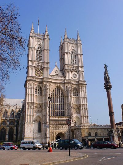 Cathedral · English HeritageWestminster Abbey10 km away4
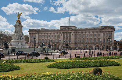 Historic houseBuckingham Palace11 km away5
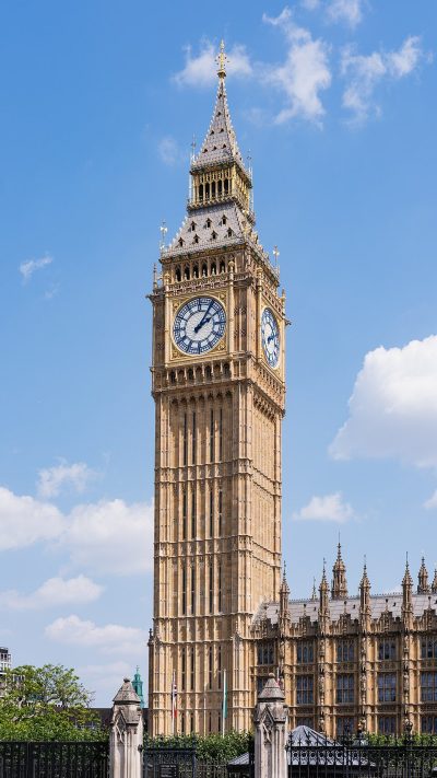 AttractionElizabeth Tower10 km away6
 CathedralSt Paul's Cathedral8 km away7
 Big drawArt galleryNational Gallery9.4 km away · 709K visitors a year (2021)8
 AttractionLondon Eye9.6 km away
Within 15 km, close and well known first. Numbers match the map.
Questions before you go
Where is Markfield Beam Engine & Museum?
Markfield Beam Engine & Museum is in Haringey, London, inside the town’s built-up area.
What is Markfield Beam Engine & Museum?
Museum in London.
When is the best time to visit Markfield Beam Engine & Museum?
May to September are the warmest months in Haringey, with afternoon highs of 18–23°C (Met Office 1991–2020 averages).
Is Markfield Beam Engine & Museum a listed building?
Yes: Grade II listed building.
What else is there to see near Markfield Beam Engine & Museum?
Within 15 km: British Museum (8.3 km), Tower of London (8.3 km), Westminster Abbey (10 km) and Buckingham Palace (11 km).
Places: OpenStreetMap (© OpenStreetMap contributors, Open Database Licence) and Wikidata (CC0), placed in the ONS 2022 built-up area (Open Government Licence v3.0). Visitor counts are the latest Wikidata gives, with their year.
Photos: each place’s Wikidata image, from Wikimedia Commons under the licence below (our copy, resized).
Photo credits (9)
- Markfield Beam Engine & Museum: Chris Allen, CC BY-SA 2.0, Wikimedia Commons
- British Museum: Ham, CC BY-SA 3.0, Wikimedia Commons
- Tower of London: Bob Collowan, CC BY-SA 3.0, Wikimedia Commons
- Westminster Abbey: Σπάρτακος, CC BY-SA 3.0, Wikimedia Commons
- Buckingham Palace: Diliff, CC BY-SA 3.0, Wikimedia Commons
- Elizabeth Tower: Christian David, CC BY-SA 4.0, Wikimedia Commons
- St Paul's Cathedral: Mark Fosh, CC BY 2.0, Wikimedia Commons
- National Gallery: Diego Delso, CC BY-SA 4.0, Wikimedia Commons
- London Eye: Christian David, CC BY-SA 4.0, Wikimedia Commons
Contains public sector information licensed under the Open Government Licence v3.0. Contains HM Land Registry data © Crown copyright and database right 2026. Contains OS data © Crown copyright and database right 2026 (ONS boundaries). Northern Ireland: Source: NISRA; contains Land & Property Services data and Ordnance Survey of Northern Ireland information, © Crown copyright, licensed under the Open Government Licence v3.0. Scotland: contains National Records of Scotland data, Registers of Scotland data and SEPA data, © Crown copyright / © SEPA 2025, licensed under the Open Government Licence v3.0.