
Lion Salt Works
Lion Salt Works is a salt works in Cheshire, UK, preserved as a museum. Inside Wincham and Marston’s built-up area is where it stands. The register lists it as a scheduled monument.
Museum in Wincham and Marston
Inside Wincham and Marston
Lion Salt Works is inside Wincham and Marston’s built-up area, with 2 more places to visit within 5 km. Towns near it ↓
Scheduled monument
On the official list of protected heritage; Wincham and Marston has 4 listed buildings in all, on its History page. About ↓
Written from OpenStreetMap, Wikidata, the ONS built-up areas and Met Office 1991–2020 averages.
Weather, month by month
Aim for June to September, when Wincham and Marston reaches 18–21°C.
Lion Salt Works
There are Wikipedia articles on it in 2 languages. Our list has 39 more places within 15 km; first among them is Halton Castle, at 15 km.
- Type
- Museum
- Listed
- Scheduled monument
- Wikipedias
- Covered in 2 languages
- Town
- in Wincham and Marston
- Official site
- lionsaltworks.westcheshiremuseums.co.uk
Practical information
- EntryA fee is charged
The area around Lion Salt Works
Spot Lion Salt Works in orange, then follow the numbers to the places below.
© OpenStreetMap contributors · The dashed line is Wincham and Marston’s built-up area. · ONS built-up area 2022
Nearby towns
The most populous of the 8 is Northwich, at 18,646. The town it is in comes first, then the others whose pages list it, nearest first.
Wincham and Marston
Northwich
Pickmere
Lostock Gralam
Compare the 8 towns
| Town | Where Lion Salt Works is | People | Places to visit |
|---|---|---|---|
| Wincham and Marston | It’s in town | 670 | 5 |
| Northwich | 600 m southwest of it | 18,646 | 6 |
| Pickmere | 1.3 km northeast of it | 2,800 | 7 |
| Lostock Gralam | 1.7 km east of it | 2,719 | 6 |
| Rudheath | 2.1 km south of it | 4,803 | 4 |
| Barnton | 2.1 km west of it | 6,245 | 4 |
| Davenham | 2.6 km south of it | 13,840 | 4 |
| Comberbach | 2.7 km northwest of it | 954 | 4 |
While you are near Lion Salt Works
Among the 39 within 15 km are 4 historic houses, 2 museums and a castle.
 CastleHalton Castle15 km away2
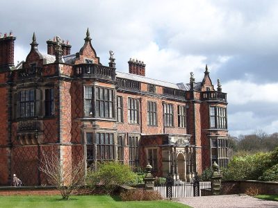 Historic houseArley Hall5.5 km away3
 MuseumWeaver Hall Museum & Workhouse2.6 km away4
 Historic houseVale Royal Abbey6.4 km away5
 MuseumCuckooland Museum5.2 km away6
 Historic house · National TrustTatton Park Mansion9.6 km away7
 Abbey or prioryNorton Priory14 km away8
 Historic house · National TrustDunham Massey Hall14 km away
Within 15 km, close and well known first. Numbers match the map.
Lion Salt Works: common questions
Where is Lion Salt Works?
Lion Salt Works is in Wincham and Marston, Cheshire, inside the town’s built-up area.
What is Lion Salt Works?
Salt works in Cheshire, UK, preserved as a museum.
When is the best time to visit Lion Salt Works?
June to September are the warmest months in Wincham and Marston, with afternoon highs of 18–21°C (Met Office 1991–2020 averages).
Is Lion Salt Works a listed building?
Yes: scheduled monument.
What else is there to see near Lion Salt Works?
Within 15 km: Halton Castle (15 km), Arley Hall (5.5 km), Weaver Hall Museum & Workhouse (2.6 km) and Vale Royal Abbey (6.4 km).
Places: OpenStreetMap (© OpenStreetMap contributors, Open Database Licence) and Wikidata (CC0), placed in the ONS 2022 built-up area (Open Government Licence v3.0). Visitor counts are the latest Wikidata gives, with their year.
Photos: each place’s Wikidata image, from Wikimedia Commons under the licence below (our copy, resized).
Photo credits (9)
- Lion Salt Works: Chris Allen, CC BY-SA 2.0, Wikimedia Commons
- Halton Castle: Rept0n1x, CC BY-SA 3.0, Wikimedia Commons
- Arley Hall: Pixie2000 at English Wikipedia, Public domain, Wikimedia Commons
- Weaver Hall Museum & Workhouse: RLamb, CC0, Wikimedia Commons
- Vale Royal Abbey: Peter I. Vardy, Public domain, Wikimedia Commons
- Cuckooland Museum: Ian Warburton, CC BY-SA 2.0, Wikimedia Commons
- Tatton Park Mansion: K. Whatley, CC BY-SA 2.0, Wikimedia Commons
- Norton Priory: Public domain, Wikimedia Commons
- Dunham Massey Hall: Photograph by Mike Peel (www.mikepeel.net)., CC BY-SA 4.0, Wikimedia Commons
Contains public sector information licensed under the Open Government Licence v3.0. Contains HM Land Registry data © Crown copyright and database right 2026. Contains OS data © Crown copyright and database right 2026 (ONS boundaries). Northern Ireland: Source: NISRA; contains Land & Property Services data and Ordnance Survey of Northern Ireland information, © Crown copyright, licensed under the Open Government Licence v3.0. Scotland: contains National Records of Scotland data, Registers of Scotland data and SEPA data, © Crown copyright / © SEPA 2025, licensed under the Open Government Licence v3.0.