
Leeds City Museum
Leeds City Museum is a museum in Leeds, England, United Kingdom, in a former mechanic's institute, later civic theatre building. It is a Grade II* listed building. Look also at Leeds Cathedral, 100 m away, first of 64 more within 15 km.
Museum in Leeds
Inside Leeds
Leeds City Museum is inside Leeds’ built-up area, with 21 more places to visit within 5 km. Towns near it ↓
Grade II* listed building
On the official list of protected heritage; Leeds has 1,223 listed buildings in all, on its History page. About ↓
Written from OpenStreetMap, Wikidata, the ONS built-up areas and Met Office 1991–2020 averages.
The best months to visit
The warmest stretch in Leeds is June to September, at 18–21°C in the afternoon.
Leeds City Museum
Readers can find it on Wikipedia in 6 languages.
- Type
- Museum
- Listed
- Grade II* listed building
- Wikipedias
- Covered in 6 languages
- Town
- in Leeds
Address and hours
Map of Leeds City Museum and nearby
Orange marks Leeds City Museum, and the numbered points match the list of places below.
© OpenStreetMap contributors · The dashed line is Leeds’ built-up area. · ONS built-up area 2022
Nearby towns
Of these 6 towns, the largest is Leeds (536,262 people). The list runs from its own town outward.
While you are near Leeds City Museum
Around it, within 15 km, lie 64 more, including 3 cathedrals, 2 museums and an art gallery.
 CathedralLeeds Cathedral100 m away2
 Art galleryLeeds Art Gallery200 m away3
 MuseumRoyal Armouries1.4 km away4
 Abbey or prioryKirkstall Abbey (Ruins)4.5 km away5
 Historic houseHarewood House11 km away6
 MuseumNational Science and Media Museum14 km away · 442K visitors a year (2015)7
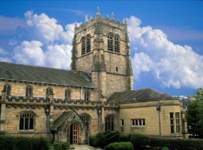 CathedralBradford Cathedral13 km away8
 CathedralWakefield Cathedral14 km away
Within 15 km, close and well known first. Numbers match the map.
Your questions on Leeds City Museum
Where is Leeds City Museum?
Leeds City Museum is in Leeds, West Yorkshire, inside the town’s built-up area.
What is Leeds City Museum?
Museum in Leeds, England, United Kingdom, in a former mechanic's institute, later civic theatre building.
When is the best time to visit Leeds City Museum?
June to September are the warmest months in Leeds, with afternoon highs of 18–21°C (Met Office 1991–2020 averages).
Is Leeds City Museum a listed building?
Yes: Grade II* listed building.
What else is there to see near Leeds City Museum?
Within 15 km: Leeds Cathedral (100 m), Leeds Art Gallery (200 m), Royal Armouries (1.4 km) and Kirkstall Abbey (Ruins) (4.5 km).
Places: OpenStreetMap (© OpenStreetMap contributors, Open Database Licence) and Wikidata (CC0), placed in the ONS 2022 built-up area (Open Government Licence v3.0). Visitor counts are the latest Wikidata gives, with their year.
Photos: each place’s Wikidata image, from Wikimedia Commons under the licence below (our copy, resized).
Photo credits (9)
- Leeds City Museum: Andrew roberts uk, CC BY-SA 3.0, Wikimedia Commons
- Leeds Cathedral: Jungpionier, CC BY-SA 3.0, Wikimedia Commons
- Leeds Art Gallery: Frank Watkins, British (fl.1859–94) (ILN staff illustrator), by T.D. Nettleton, Public domain, Wikimedia Commons
- Royal Armouries: Tim Marchant, CC BY-SA 2.0, Wikimedia Commons
- Kirkstall Abbey (Ruins): JohnArmagh, Public domain, Wikimedia Commons
- Harewood House: Sirenuk, CC BY-SA 3.0, Wikimedia Commons
- National Science and Media Museum: Chemical Engineer, CC BY-SA 4.0, Wikimedia Commons
- Bradford Cathedral: Mick Melvin, CC BY-SA 2.0, Wikimedia Commons
- Wakefield Cathedral: Mike Kirby, CC BY-SA 2.0, Wikimedia Commons
Contains public sector information licensed under the Open Government Licence v3.0. Contains HM Land Registry data © Crown copyright and database right 2026. Contains OS data © Crown copyright and database right 2026 (ONS boundaries). Northern Ireland: Source: NISRA; contains Land & Property Services data and Ordnance Survey of Northern Ireland information, © Crown copyright, licensed under the Open Government Licence v3.0. Scotland: contains National Records of Scotland data, Registers of Scotland data and SEPA data, © Crown copyright / © SEPA 2025, licensed under the Open Government Licence v3.0.