
Kelvedon Hatch Secret Nuclear Bunker
Kelvedon Hatch Secret Nuclear Bunker is a rOTOR air defence control bunker converted to a Regional Seat of Government. On the map, it sits 700 m northwest of Kelvedon Hatch. Close by, Brentwood Cathedral is 6.8 km away, one of 25 within 15 km.
Fort near Kelvedon Hatch
Just outside Kelvedon Hatch
Kelvedon Hatch Secret Nuclear Bunker is 700 m northwest of Kelvedon Hatch. Towns near it ↓
Written from OpenStreetMap, Wikidata, the ONS built-up areas and Met Office 1991–2020 averages.
Weather by the month
Warm weather in Kelvedon Hatch runs May to September, with highs of 17–23°C.
Kelvedon Hatch Secret Nuclear Bunker
It has articles in 3 Wikipedias.
- Type
- Fort
- Wikipedias
- Covered in 3 languages
- Town
- 700 m northwest of Kelvedon Hatch
- Official site
- secretnuclearbunker.co.uk
Its place on the map
On this map, Kelvedon Hatch Secret Nuclear Bunker is orange and its neighbours are numbered.
© OpenStreetMap contributors · ONS built-up area 2022
The nearest towns
The most populous of the 6 is Brentwood, at 55,339. Pick a base: each town is a page of its own, with what else there is to see.
Kelvedon Hatch
Doddinghurst
Brentwood
Chipping Ongar
Compare the 6 towns
| Town | Where Kelvedon Hatch Secret Nuclear Bunker is | People | Places to visit |
|---|---|---|---|
| Kelvedon Hatch | 700 m southeast of it | 2,493 | 4 |
| Doddinghurst | 2.3 km east of it | 4,067 | 4 |
| Brentwood | 2.4 km southeast of it | 55,339 | 10 |
| Chipping Ongar | 2.5 km north of it | 3,922 | 4 |
| Blackmore | 4.4 km northeast of it | 1,167 | 1 |
| Shelley | 4.5 km north of it | 2,405 | 5 |
Pair Kelvedon Hatch Secret Nuclear Bunker with these
Within 15 km you can add 5 historic houses, a cathedral and a heritage railway.
 CathedralBrentwood Cathedral6.8 km away2
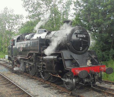 Heritage railwayEpping Ongar Railway6.6 km away3
 Historic houseHylands House13 km away4
 Historic houseIngatestone Hall9.3 km away5
 Historic houseThorndon Hall9.6 km away6
 Historic houseHill Hall7.2 km away7
 MuseumHavering Museum12 km away8
 Historic houseCopped Hall13 km away
Within 15 km, close and well known first. Numbers match the map.
Questions people have about Kelvedon Hatch Secret Nuclear Bunker
Where is Kelvedon Hatch Secret Nuclear Bunker?
Kelvedon Hatch Secret Nuclear Bunker is 700 m northwest of Kelvedon Hatch, Essex.
What is Kelvedon Hatch Secret Nuclear Bunker?
ROTOR air defence control bunker converted to a Regional Seat of Government.
When is the best time to visit Kelvedon Hatch Secret Nuclear Bunker?
May to September are the warmest months in Kelvedon Hatch, with afternoon highs of 17–23°C (Met Office 1991–2020 averages).
What else is there to see near Kelvedon Hatch Secret Nuclear Bunker?
Within 15 km: Brentwood Cathedral (6.8 km), Epping Ongar Railway (6.6 km), Hylands House (13 km) and Ingatestone Hall (9.3 km).
Places: OpenStreetMap (© OpenStreetMap contributors, Open Database Licence) and Wikidata (CC0), placed in the ONS 2022 built-up area (Open Government Licence v3.0). Visitor counts are the latest Wikidata gives, with their year.
Photos: each place’s Wikidata image, from Wikimedia Commons under the licence below (our copy, resized).
Photo credits (9)
- Kelvedon Hatch Secret Nuclear Bunker: Genesisman26 at English Wikipedia, Public domain, Wikimedia Commons
- Brentwood Cathedral: Brentwood_Cathedral_-_Rfry.jpg: Rhyddfrydol derivative work: Rabanus Flavus, CC BY-SA 3.0, Wikimedia Commons
- Epping Ongar Railway: PeterSkuce, CC BY-SA 4.0, Wikimedia Commons
- Hylands House: Graham Pearce, Public domain, Wikimedia Commons
- Ingatestone Hall: John S Turner, CC BY-SA 2.0, Wikimedia Commons
- Thorndon Hall: Tomharveybolton, Public domain, Wikimedia Commons
- Hill Hall: Stephen Richards, CC BY-SA 2.0, Wikimedia Commons
- Havering Museum: Mx. Granger, CC0, Wikimedia Commons
- Copped Hall: Acabashi, CC BY-SA 4.0, Wikimedia Commons
Contains public sector information licensed under the Open Government Licence v3.0. Contains HM Land Registry data © Crown copyright and database right 2026. Contains OS data © Crown copyright and database right 2026 (ONS boundaries). Northern Ireland: Source: NISRA; contains Land & Property Services data and Ordnance Survey of Northern Ireland information, © Crown copyright, licensed under the Open Government Licence v3.0. Scotland: contains National Records of Scotland data, Registers of Scotland data and SEPA data, © Crown copyright / © SEPA 2025, licensed under the Open Government Licence v3.0.