
Harlow Town Park
Harlow Town Park is a park in Harlow, Essex. It is protected as a Grade II listed park and garden. Add Henry Moore Foundation, 6.6 km away, to a visit; it leads 33 places within 15 km.
Garden in Harlow
Inside Harlow
Harlow Town Park is inside Harlow’s built-up area, with 2 more places to visit within 5 km. Towns near it ↓
Grade II listed park and garden
On the official list of protected heritage; Harlow has 178 listed buildings in all, on its History page. About ↓
Written from OpenStreetMap, Wikidata, the ONS built-up areas and Met Office 1991–2020 averages.
The year in Harlow
For warmth, aim for May to September (18–23°C highs in Harlow).
Harlow Town Park
Its story is told in 4 languages on Wikipedia.
- Type
- Garden
- Listed
- Grade II listed park and garden
- Wikipedias
- Covered in 4 languages
- Town
- in Harlow
Where Harlow Town Park is
Harlow Town Park sits at the orange dot; the numbered ones are listed below.
© OpenStreetMap contributors · The dashed line is Harlow’s built-up area. · ONS built-up area 2022
Towns that count Harlow Town Park
The biggest base of the 6 is Harlow (93,570 people). Its own town leads; the rest list it too, closest first.
Harlow
Sawbridgeworth
Roydon
Roydon Hamlet
Compare the 6 towns
| Town | Where Harlow Town Park is | People | Places to visit |
|---|---|---|---|
| Harlow | It’s in town | 93,570 | 10 |
| Sawbridgeworth | 2.5 km northeast of it | 10,471 | 8 |
| Roydon | 3.5 km west of it | 1,587 | 4 |
| Roydon Hamlet | 4.1 km southwest of it | 436 | 4 |
| Broadley Common | 4.1 km southwest of it | 390 | 3 |
| Hunsdon | 4.3 km northwest of it | 990 | 7 |
Places to add to Harlow Town Park
Our list has 33 more within 15 km, among them 3 castles, 2 historic houses and an art gallery.
 Art galleryHenry Moore Foundation6.6 km away2
 CastleHertford Castle Gate House13 km away3
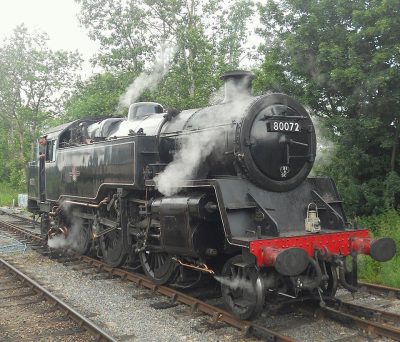 Heritage railwayEpping Ongar Railway9.4 km away4
 CastleWaytemore Castle (remains)11 km away5
 ZooHertfordshire Zoo11 km away6
 Historic houseCopped Hall9.7 km away7
 Historic houseDown Hall7.5 km away8
 CastleRye House Gatehouse6.5 km away
Within 15 km, close and well known first. Numbers match the map.
Harlow Town Park, answered
Where is Harlow Town Park?
Harlow Town Park is in Harlow, Essex, inside the town’s built-up area.
What is Harlow Town Park?
Park in Harlow, Essex, England, UK.
When is the best time to visit Harlow Town Park?
May to September are the warmest months in Harlow, with afternoon highs of 18–23°C (Met Office 1991–2020 averages).
Is Harlow Town Park a listed building?
Yes: Grade II listed park and garden.
What else is there to see near Harlow Town Park?
Within 15 km: Henry Moore Foundation (6.6 km), Hertford Castle Gate House (13 km), Epping Ongar Railway (9.4 km) and Waytemore Castle (remains) (11 km).
Places: OpenStreetMap (© OpenStreetMap contributors, Open Database Licence) and Wikidata (CC0), placed in the ONS 2022 built-up area (Open Government Licence v3.0). Visitor counts are the latest Wikidata gives, with their year.
Photos: each place’s Wikidata image, from Wikimedia Commons under the licence below (our copy, resized).
Photo credits (9)
- Harlow Town Park: Roger McLachlan, CC BY-SA 2.0, Wikimedia Commons
- Henry Moore Foundation: DeFacto, CC BY-SA 4.0, Wikimedia Commons
- Hertford Castle Gate House: Caitlin from Hertfordshire, UK, CC BY 2.0, Wikimedia Commons
- Epping Ongar Railway: PeterSkuce, CC BY-SA 4.0, Wikimedia Commons
- Waytemore Castle (remains): PAUL FARMER, CC BY-SA 2.0, Wikimedia Commons
- Hertfordshire Zoo: William Warby from London, England, CC BY 2.0, Wikimedia Commons
- Copped Hall: Acabashi, CC BY-SA 4.0, Wikimedia Commons
- Down Hall: Polly, CC BY-SA 2.0, Wikimedia Commons
- Rye House Gatehouse: Robert Edwards, CC BY-SA 2.0, Wikimedia Commons
Contains public sector information licensed under the Open Government Licence v3.0. Contains HM Land Registry data © Crown copyright and database right 2026. Contains OS data © Crown copyright and database right 2026 (ONS boundaries). Northern Ireland: Source: NISRA; contains Land & Property Services data and Ordnance Survey of Northern Ireland information, © Crown copyright, licensed under the Open Government Licence v3.0. Scotland: contains National Records of Scotland data, Registers of Scotland data and SEPA data, © Crown copyright / © SEPA 2025, licensed under the Open Government Licence v3.0.