E-Scape
E-Scape is an attraction; it lies 100 m east of Runcorn. A short trip away is Halton Castle, 3.5 km off, the first of 30 within 15 km.
Attraction near Runcorn
Just outside Runcorn
E-Scape is 100 m east of Runcorn. Towns near it ↓
Written from OpenStreetMap, Wikidata, the ONS built-up areas and Met Office 1991–2020 averages.
Weather, month by month
Afternoons in Runcorn reach 17–21°C from May to September.
E-Scape
Attraction.
- Type
- Attraction
- Town
- 100 m east of Runcorn
- Official site
- e-scape.org.uk
The way to E-Scape
E-Scape is in orange, with the places near it numbered as below.
© OpenStreetMap contributors · ONS built-up area 2022
Where people come from
Warrington is the biggest of the 6 bases nearby (174,968 people). Its home town tops the list; the rest follow by distance.
Runcorn
Moore
Widnes
Frodsham
Compare the 6 towns
| Town | Where E-Scape is | People | Places to visit |
|---|---|---|---|
| Runcorn | 100 m west of it | 61,641 | 16 |
| Moore | 3 km north of it | 577 | 13 |
| Widnes | 4.2 km northwest of it | 59,938 | 17 |
| Frodsham | 4.3 km southwest of it | 9,101 | 6 |
| Warrington | 4.8 km northeast of it | 174,968 | 18 |
| Acton Bridge | 4.8 km southeast of it | 185 | 2 |
What else is near E-Scape
There are 30 within 15 km, 2 museums, 2 historic houses and a castle among them.
 CastleHalton Castle3.5 km away2
 Abbey or prioryNorton Priory3.2 km away3
 MuseumCatalyst Museum6.7 km away4
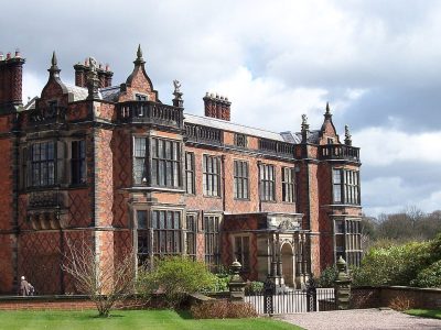 Historic houseArley Hall10 km away5
 Fort · National TrustHelsby Hillfort9.4 km away6
 Theme parkGulliver's World9.5 km away7
 Historic houseVale Royal Abbey13 km away8
 MuseumWarrington Museum & Art Gallery8 km away
Within 15 km, close and well known first. Numbers match the map.
E-Scape in questions
Where is E-Scape?
E-Scape is 100 m east of Runcorn, Cheshire.
What is E-Scape?
Attraction.
When is the best time to visit E-Scape?
May to September are the warmest months in Runcorn, with afternoon highs of 17–21°C (Met Office 1991–2020 averages).
What else is there to see near E-Scape?
Within 15 km: Halton Castle (3.5 km), Norton Priory (3.2 km), Catalyst Museum (6.7 km) and Arley Hall (10 km).
Places: OpenStreetMap (© OpenStreetMap contributors, Open Database Licence) and Wikidata (CC0), placed in the ONS 2022 built-up area (Open Government Licence v3.0). Visitor counts are the latest Wikidata gives, with their year.
Photos: each place’s Wikidata image, from Wikimedia Commons under the licence below (our copy, resized).
Photo credits (8)
- Halton Castle: Rept0n1x, CC BY-SA 3.0, Wikimedia Commons
- Norton Priory: Public domain, Wikimedia Commons
- Catalyst Museum: Chemical Engineer, CC BY-SA 3.0, Wikimedia Commons
- Arley Hall: Pixie2000 at English Wikipedia, Public domain, Wikimedia Commons
- Helsby Hillfort: Jeff Buck, CC BY-SA 2.0, Wikimedia Commons
- Gulliver's World: Gulliver's Theme Park Resorts, CC BY-SA 4.0, Wikimedia Commons
- Vale Royal Abbey: Peter I. Vardy, Public domain, Wikimedia Commons
- Warrington Museum & Art Gallery: RDJ226, CC BY 3.0, Wikimedia Commons
Contains public sector information licensed under the Open Government Licence v3.0. Contains HM Land Registry data © Crown copyright and database right 2026. Contains OS data © Crown copyright and database right 2026 (ONS boundaries). Northern Ireland: Source: NISRA; contains Land & Property Services data and Ordnance Survey of Northern Ireland information, © Crown copyright, licensed under the Open Government Licence v3.0. Scotland: contains National Records of Scotland data, Registers of Scotland data and SEPA data, © Crown copyright / © SEPA 2025, licensed under the Open Government Licence v3.0.