
Danum Gallery, Library and Museum
Danum Gallery, Library and Museum is a museum in Doncaster. The site is in the hands of City of Doncaster Council. Look also at Conisbrough Castle, 7.6 km away, first of 11 more within 15 km.
Museum in Doncaster
Inside Doncaster
Danum Gallery, Library and Museum is inside Doncaster’s built-up area, with 4 more places to visit within 5 km. Towns near it ↓
Written from OpenStreetMap, Wikidata, the ONS built-up areas and Met Office 1991–2020 averages.
Month by month
In Doncaster, May to September bring the warmest days: highs of 17–22°C.
Danum Gallery, Library and Museum
Its Wikipedia coverage spans 3 languages.
- Type
- Museum
- Run by
- City of Doncaster Council
- Wikipedias
- Covered in 3 languages
- Town
- in Doncaster
- Official site
- dglam.org.uk
Address and hours
Where it sits
Numbered points are the places near Danum Gallery, Library and Museum, which is in orange.
© OpenStreetMap contributors · The dashed line is Doncaster’s built-up area. · ONS built-up area 2022
Bases near Danum Gallery, Library and Museum
Among the 8, Doncaster is the biggest, home to 87,440 people. From nearest to farthest, these towns all list it.
- 1Doncaster
- 2Bentley
- 3Sprotbrough
- 4Scawthorpe and Cusworth
- 5Arksey
- 6Warmsworth
- 7Armthorpe
- 8New Rossington and Rossington
Doncaster
Bentley
Sprotbrough
Scawthorpe and Cusworth
Compare the 8 towns
| Town | Where Danum Gallery, Library and Museum is | People | Places to visit |
|---|---|---|---|
| Doncaster | It’s in town | 87,440 | 8 |
| Bentley | 1.3 km northwest of it | 12,044 | 5 |
| Sprotbrough | 1.5 km west of it | 7,546 | 6 |
| Scawthorpe and Cusworth | 2.3 km northwest of it | 13,020 | 6 |
| Arksey | 3.3 km north of it | 1,578 | 4 |
| Warmsworth | 3.6 km southwest of it | 11,317 | 6 |
| Armthorpe | 4 km east of it | 14,161 | 4 |
| New Rossington and Rossington | 4.1 km southeast of it | 13,911 | 7 |
While you are near Danum Gallery, Library and Museum
3 museums, 2 castles and a zoo are among the 11 within 15 km.
 MuseumCusworth Hall3.3 km away3
 ZooYorkshire Wildlife Park6.6 km away4
 Garden · English HeritageBrodsworth Hall and Gardens8.2 km away5MuseumMuseumSouth Yorkshire Air Museum1.6 km away6
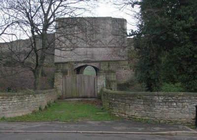 CastleTickhill Castle10 km away7
 Abbey or priory · English HeritageRoche Abbey14 km away8MuseumMuseumKings Own Yorkshire Light Infantry Museum100 m away
Within 15 km, close and well known first. Numbers match the map.
Questions people have about Danum Gallery, Library and Museum
Where is Danum Gallery, Library and Museum?
Danum Gallery, Library and Museum is in Doncaster, South Yorkshire, inside the town’s built-up area.
What is Danum Gallery, Library and Museum?
Museum in Doncaster, United Kingdom.
Who runs Danum Gallery, Library and Museum?
City of Doncaster Council.
When is the best time to visit Danum Gallery, Library and Museum?
May to September are the warmest months in Doncaster, with afternoon highs of 17–22°C (Met Office 1991–2020 averages).
What else is there to see near Danum Gallery, Library and Museum?
Within 15 km: Conisbrough Castle (7.6 km), Cusworth Hall (3.3 km), Yorkshire Wildlife Park (6.6 km) and Brodsworth Hall and Gardens (8.2 km).
Places: OpenStreetMap (© OpenStreetMap contributors, Open Database Licence) and Wikidata (CC0), placed in the ONS 2022 built-up area (Open Government Licence v3.0). Visitor counts are the latest Wikidata gives, with their year.
Photos: each place’s Wikidata image, from Wikimedia Commons under the licence below (our copy, resized).
Photo credits (6)
- Danum Gallery, Library and Museum: Marasmusine (Janine Timiney), Public domain, Wikimedia Commons
- Cusworth Hall: Foto43, CC BY 2.0, Wikimedia Commons
- Yorkshire Wildlife Park: steven ruffles, CC BY-SA 2.0, Wikimedia Commons
- Brodsworth Hall and Gardens: Richard Croft, CC BY-SA 2.0, Wikimedia Commons
- Tickhill Castle: original: Michael Patterson derivative work: Paravane, CC BY-SA 2.0, Wikimedia Commons
- Roche Abbey: Alison Stamp, CC BY-SA 2.0, Wikimedia Commons
Contains public sector information licensed under the Open Government Licence v3.0. Contains HM Land Registry data © Crown copyright and database right 2026. Contains OS data © Crown copyright and database right 2026 (ONS boundaries). Northern Ireland: Source: NISRA; contains Land & Property Services data and Ordnance Survey of Northern Ireland information, © Crown copyright, licensed under the Open Government Licence v3.0. Scotland: contains National Records of Scotland data, Registers of Scotland data and SEPA data, © Crown copyright / © SEPA 2025, licensed under the Open Government Licence v3.0.