
Chertsey Abbey
Chertsey Abbey is a Benedictine monastery. Look for it within Chertsey’s built-up area. It is on the official list as a scheduled monument.
Abbey or priory in Chertsey
Inside Chertsey
Chertsey Abbey is inside Chertsey’s built-up area, with 32 more places to visit within 5 km. Towns near it ↓
Scheduled monument
On the official list of protected heritage; Chertsey has 96 listed buildings in all, on its History page. About ↓
Written from OpenStreetMap, Wikidata, the ONS built-up areas and Met Office 1991–2020 averages.
Month by month
May to September are the warmest in Chertsey, with afternoon highs of 18–23°C.
Chertsey Abbey
Its story is told in 6 languages on Wikipedia. Our list has 132 more places within 15 km; first among them is Windsor Castle, at 12 km.
- Type
- Abbey or priory
- Listed
- Scheduled monument
- Wikipedias
- Covered in 6 languages
- Town
- in Chertsey
Mapping Chertsey Abbey
Find Chertsey Abbey in orange; each number is a place listed below.
© OpenStreetMap contributors · The dashed line is Chertsey’s built-up area. · ONS built-up area 2022
The towns around Chertsey Abbey
The largest of the 8 towns is Staines-upon-Thames, with 21,327 people. Nearest first, every town here counts it among its places to visit.
Chertsey
Penton Hook
Staines-upon-Thames
Laleham
Compare the 8 towns
| Town | Where Chertsey Abbey is | People | Places to visit |
|---|---|---|---|
| Chertsey | It’s in town | 14,558 | 35 |
| Penton Hook | 500 m north of it | 404 | 23 |
| Staines-upon-Thames | 800 m north of it | 21,327 | 31 |
| Laleham | 1.3 km north of it | 2,521 | 24 |
| Addlestone | 1.6 km south of it | 13,748 | 32 |
| Lyne | 1.7 km west of it | 1,202 | 24 |
| Weybridge | 1.9 km southeast of it | 15,918 | 45 |
| Shepperton Green | 2.1 km east of it | 4,358 | 34 |
Beyond Chertsey Abbey
132 more lie within 15 km, 2 theme parks, 2 historic houses and 2 attractions among them.
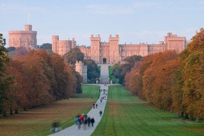 CastleWindsor Castle12 km away2Theme parkBig drawTheme parkThorpe Park1.4 km away · 1.6M visitors a year (2024)3
 Historic house · Historic Royal PalacesHampton Court Palace11 km away4
 Garden · National TrustRunnymede6.6 km away5
 AttractionColossus1.4 km away6
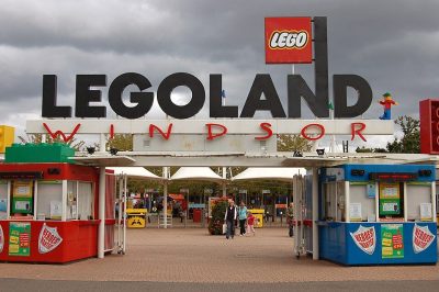 Big drawTheme parkLegoland Windsor13 km away · 2.3M visitors a year (2024)7
 Historic house · National TrustOsterley House15 km away · 350K visitors a year8
 AttractionHyperia1.2 km away
Within 15 km, close and well known first. Numbers match the map.
Before visiting Chertsey Abbey
Where is Chertsey Abbey?
Chertsey Abbey is in Chertsey, Surrey, inside the town’s built-up area.
What is Chertsey Abbey?
Benedictine monastery.
When is the best time to visit Chertsey Abbey?
May to September are the warmest months in Chertsey, with afternoon highs of 18–23°C (Met Office 1991–2020 averages).
Is Chertsey Abbey a listed building?
Yes: scheduled monument.
What else is there to see near Chertsey Abbey?
Within 15 km: Windsor Castle (12 km), Thorpe Park (1.4 km), Hampton Court Palace (11 km) and Runnymede (6.6 km).
Places: OpenStreetMap (© OpenStreetMap contributors, Open Database Licence) and Wikidata (CC0), placed in the ONS 2022 built-up area (Open Government Licence v3.0). Visitor counts are the latest Wikidata gives, with their year.
Photos: each place’s Wikidata image, from Wikimedia Commons under the licence below (our copy, resized).
Photo credits (8)
- Chertsey Abbey: David Hawgood, CC BY-SA 2.0, Wikimedia Commons
- Windsor Castle: Diliff, CC BY 2.5, Wikimedia Commons
- Hampton Court Palace: Ricardalovesmonuments, CC BY-SA 4.0, Wikimedia Commons
- Runnymede: Wyrdlight, CC BY 3.0, Wikimedia Commons
- Colossus: Stefan Scheer, CC BY-SA 3.0, Wikimedia Commons
- Legoland Windsor: Rob Young profile, CC BY 2.0, Wikimedia Commons
- Osterley House: Osterley Park House, London-25June2009.jpg: Jim Linwood derivative work: Snowmanradio, CC BY 2.0, Wikimedia Commons
- Hyperia: Suntooooth, CC BY-SA 4.0, Wikimedia Commons
Contains public sector information licensed under the Open Government Licence v3.0. Contains HM Land Registry data © Crown copyright and database right 2026. Contains OS data © Crown copyright and database right 2026 (ONS boundaries). Northern Ireland: Source: NISRA; contains Land & Property Services data and Ordnance Survey of Northern Ireland information, © Crown copyright, licensed under the Open Government Licence v3.0. Scotland: contains National Records of Scotland data, Registers of Scotland data and SEPA data, © Crown copyright / © SEPA 2025, licensed under the Open Government Licence v3.0.