
British Motor Museum
British Motor Museum is a transport museum. Its location is inside Lighthorne Heath’s built-up area. There are 22 more places to see within 15 km, beginning with Warwick Castle (12 km).
Museum in Lighthorne Heath
Inside Lighthorne Heath
British Motor Museum is inside Lighthorne Heath’s built-up area, with 2 more places to visit within 5 km. Towns near it ↓
Written from OpenStreetMap, Wikidata, the ONS built-up areas and Met Office 1991–2020 averages.
Month by month
In Lighthorne Heath the warm season is June to September, with highs of 19–22°C.
British Motor Museum
It has articles in 4 Wikipedias.
- Type
- Museum
- Wikipedias
- Covered in 4 languages
- Town
- in Lighthorne Heath
- Official site
- britishmotormuseum.co.uk
British Motor Museum and what surrounds it
The map centres on British Motor Museum, in orange, with nearby places numbered.
© OpenStreetMap contributors · The dashed line is Lighthorne Heath’s built-up area. · ONS built-up area 2022
Bases for a visit
Of the 8, Bishop's Itchington is the largest, at 2,530 people. Every town below has its own grades, prices and places to visit.
- 1Lighthorne Heath
- 2Gaydon
- 3Lighthorne
- 4Temple Herdewyke
- 5Kineton
- 6Northend
- 7Bishop's Itchington
- 8Moreton Morrell
Lighthorne Heath
Gaydon
Lighthorne
Temple Herdewyke
Compare the 8 towns
| Town | Where British Motor Museum is | People | Places to visit |
|---|---|---|---|
| Lighthorne Heath | It’s in town | 994 | 3 |
| Gaydon | 700 m southeast of it | 530 | 3 |
| Lighthorne | 1.6 km northwest of it | 432 | 3 |
| Temple Herdewyke | 3.1 km southeast of it | 665 | 2 |
| Kineton | 3.5 km southwest of it | 2,235 | 3 |
| Northend | 3.8 km southeast of it | 274 | 4 |
| Bishop's Itchington | 3.9 km northeast of it | 2,530 | 2 |
| Moreton Morrell | 4.4 km west of it | 341 | 6 |
What else is near British Motor Museum
The 22 places within 15 km include 3 historic houses, 2 castles and an art gallery.
 CastleWarwick Castle12 km away2
 Historic house · National TrustCharlecote Park9.9 km away3
 Historic house · National TrustUpton House9.1 km away4
 Art galleryCompton Verney Art Gallery4.9 km away5
 CastleCompton Wynyates13 km away6
 Historic houseFarnborough Hall9.3 km away7MuseumMuseumChedham's Yard7.6 km away8
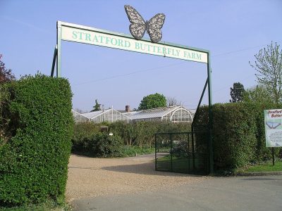 ZooStratford Butterfly Farm15 km away
Within 15 km, close and well known first. Numbers match the map.
Questions people have about British Motor Museum
Where is British Motor Museum?
British Motor Museum is in Lighthorne Heath, Warwickshire, inside the town’s built-up area.
What is British Motor Museum?
Transport museum in Gaydon, United Kingdom.
When is the best time to visit British Motor Museum?
June to September are the warmest months in Lighthorne Heath, with afternoon highs of 19–22°C (Met Office 1991–2020 averages).
What else is there to see near British Motor Museum?
Within 15 km: Warwick Castle (12 km), Charlecote Park (9.9 km), Upton House (9.1 km) and Compton Verney Art Gallery (4.9 km).
Places: OpenStreetMap (© OpenStreetMap contributors, Open Database Licence) and Wikidata (CC0), placed in the ONS 2022 built-up area (Open Government Licence v3.0). Visitor counts are the latest Wikidata gives, with their year.
Photos: each place’s Wikidata image, from Wikimedia Commons under the licence below (our copy, resized).
Photo credits (8)
- British Motor Museum: Andy C at English Wikipedia, Public domain, Wikimedia Commons
- Warwick Castle: DeFacto, CC BY-SA 4.0, Wikimedia Commons
- Charlecote Park: David Dixon, CC BY-SA 2.0, Wikimedia Commons
- Upton House: Lee Jones, CC BY-SA 2.0, Wikimedia Commons
- Compton Verney Art Gallery: Darius Khan, CC BY-SA 2.0, Wikimedia Commons
- Compton Wynyates: Norman Crump, CC BY-SA 2.0, Wikimedia Commons
- Farnborough Hall: Nicholas Jackson, CC BY-SA 3.0, Wikimedia Commons
- Stratford Butterfly Farm: Snowmanradio, CC BY-SA 3.0, Wikimedia Commons
Contains public sector information licensed under the Open Government Licence v3.0. Contains HM Land Registry data © Crown copyright and database right 2026. Contains OS data © Crown copyright and database right 2026 (ONS boundaries). Northern Ireland: Source: NISRA; contains Land & Property Services data and Ordnance Survey of Northern Ireland information, © Crown copyright, licensed under the Open Government Licence v3.0. Scotland: contains National Records of Scotland data, Registers of Scotland data and SEPA data, © Crown copyright / © SEPA 2025, licensed under the Open Government Licence v3.0.