
Baysgarth House Museum
Baysgarth House Museum is an archaeological and Social History Museum. Inside Barton-upon-Humber’s built-up area is where it stands. Within 15 km there are 26 more places to visit, starting with Wilderspin National School (600 m).
Museum in Barton-upon-Humber
Inside Barton-upon-Humber
Baysgarth House Museum is inside Barton-upon-Humber’s built-up area, with 5 more places to visit within 5 km. Towns near it ↓
Written from OpenStreetMap, Wikidata, the ONS built-up areas and Met Office 1991–2020 averages.
Weather, month by month
The warmest afternoons in Barton-upon-Humber run June to September, at 18–21°C.
Baysgarth House Museum
Archaeological and Social History Museum in North Lincolnshire, UK.
In Barton-upon-Humber, inside the town’s built-up area.
- Type
- Museum
- Town
- in Barton-upon-Humber
Getting to Baysgarth House Museum
Orange is Baysgarth House Museum; numbered in green, the places near it.
© OpenStreetMap contributors · The dashed line is Barton-upon-Humber’s built-up area. · ONS built-up area 2022
Nearby towns
By population, Kingston upon Hull leads the 7 with 270,816. Each town here links to its own guide.
- 1Barton-upon-Humber
- 2Barrow upon Humber
- 3Hessle
- 4South Ferriby
- 5Kingston upon Hull
- 6North Ferriby
- 7New Holland
Barton-upon-Humber
Barrow upon Humber
Hessle
South Ferriby
Compare the 7 towns
| Town | Where Baysgarth House Museum is | People | Places to visit |
|---|---|---|---|
| Barton-upon-Humber | It’s in town | 11,927 | 7 |
| Barrow upon Humber | 3.2 km east of it | 2,843 | 8 |
| Hessle | 3.8 km north of it | 15,489 | 8 |
| South Ferriby | 4.3 km west of it | 638 | 6 |
| Kingston upon Hull | 4.6 km northeast of it | 270,816 | 23 |
| North Ferriby | 4.8 km northwest of it | 3,964 | 6 |
| New Holland | 4.9 km east of it | 993 | 19 |
Nearby, too
Within 15 km are 26 places, among them 7 museums and a fort.
 MuseumWilderspin National School600 m away2
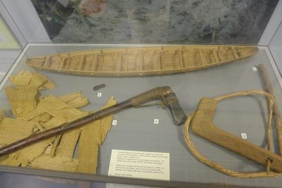 MuseumFerriby Boats5.7 km away3
 MuseumHull Streetlife Museum10 km away · 126K visitors a year4
 MuseumRopewalk1.4 km away5
 FortHull Castle10 km away6
 MuseumHull Maritime Museum9.7 km away7
 MuseumArctic Corsair10 km away8
 MuseumFerens Art Gallery9.6 km away
Within 15 km, close and well known first. Numbers match the map.
Questions people have about Baysgarth House Museum
Where is Baysgarth House Museum?
Baysgarth House Museum is in Barton-upon-Humber, Lincolnshire, inside the town’s built-up area.
What is Baysgarth House Museum?
Archaeological and Social History Museum in North Lincolnshire, UK.
When is the best time to visit Baysgarth House Museum?
June to September are the warmest months in Barton-upon-Humber, with afternoon highs of 18–21°C (Met Office 1991–2020 averages).
What else is there to see near Baysgarth House Museum?
Within 15 km: Wilderspin National School (600 m), Ferriby Boats (5.7 km), Hull Streetlife Museum (10 km) and Ropewalk (1.4 km).
Places: OpenStreetMap (© OpenStreetMap contributors, Open Database Licence) and Wikidata (CC0), placed in the ONS 2022 built-up area (Open Government Licence v3.0). Visitor counts are the latest Wikidata gives, with their year.
Photos: each place’s Wikidata image, from Wikimedia Commons under the licence below (our copy, resized).
Photo credits (9)
- Baysgarth House Museum: David Wright, CC BY-SA 2.0, Wikimedia Commons
- Wilderspin National School: David Wright, CC BY-SA 2.0, Wikimedia Commons
- Ferriby Boats: Notafly, CC BY-SA 4.0, Wikimedia Commons
- Hull Streetlife Museum: Peter Church, CC BY-SA 2.0, Wikimedia Commons
- Ropewalk: David Wright, CC BY-SA 2.0, Wikimedia Commons
- Hull Castle: Wenceslaus Hollar (1607–1677), Public domain, Wikimedia Commons
- Hull Maritime Museum: Paul Harrop, CC BY-SA 2.0, Wikimedia Commons
- Arctic Corsair: Hullian111, CC BY-SA 4.0, Wikimedia Commons
- Ferens Art Gallery: Andy Beecroft, CC BY-SA 2.0, Wikimedia Commons
Contains public sector information licensed under the Open Government Licence v3.0. Contains HM Land Registry data © Crown copyright and database right 2026. Contains OS data © Crown copyright and database right 2026 (ONS boundaries). Northern Ireland: Source: NISRA; contains Land & Property Services data and Ordnance Survey of Northern Ireland information, © Crown copyright, licensed under the Open Government Licence v3.0. Scotland: contains National Records of Scotland data, Registers of Scotland data and SEPA data, © Crown copyright / © SEPA 2025, licensed under the Open Government Licence v3.0.