
Bardney Abbey
Bardney Abbey is an abbey in Bardney, West Lindsey, Lincolnshire. It holds the status of a scheduled monument. Add Lincoln Cathedral, 14 km away, to a visit; it leads 26 places within 15 km.
Abbey or priory near Bardney
Just outside Bardney
Bardney Abbey is 400 m northwest of Bardney. Towns near it ↓
Scheduled monument
On the official list of protected heritage; Bardney has 10 listed buildings in all, on its History page. About ↓
Written from OpenStreetMap, Wikidata, the ONS built-up areas and Met Office 1991–2020 averages.
When to go
Expect highs of 19–22°C in Bardney from June to September.
Bardney Abbey
Management falls to Society for Lincolnshire History and Archaeology. Its Wikipedia coverage spans 5 languages.
- Type
- Abbey or priory
- Run by
- Society for Lincolnshire History and Archaeology
- Listed
- Scheduled monument
- Wikipedias
- Covered in 5 languages
- Town
- 400 m northwest of Bardney
Map of Bardney Abbey and nearby
Orange marks Bardney Abbey, and the numbered points match the list of places below.
© OpenStreetMap contributors · ONS built-up area 2022
Towns that list Bardney Abbey
Cherry Willingham tops the 8 for size, at 3,446 people. The town it is in comes first, then the others whose pages list it, nearest first.
Bardney
Fiskerton
Potterhanworth
Langworth
Compare the 8 towns
| Town | Where Bardney Abbey is | People | Places to visit |
|---|---|---|---|
| Bardney | 400 m southeast of it | 2,069 | 4 |
| Fiskerton | 6.4 km west of it | 1,202 | 3 |
| Potterhanworth | 7.3 km southwest of it | 497 | 1 |
| Langworth | 7.6 km northwest of it | 528 | 3 |
| Wragby | 7.8 km north of it | 1,859 | 2 |
| Reepham | 8.1 km northwest of it | 619 | 3 |
| Cherry Willingham | 8.3 km west of it | 3,446 | 13 |
| Nocton | 8.3 km southwest of it | 911 | 1 |
Around Bardney Abbey
Of the 26 within 15 km, look for 3 museums, 2 abbeys or priories and a cathedral.
 CathedralLincoln Cathedral14 km away2
 CastleLincoln Castle14 km away3
 MuseumLincoln Museum14 km away4
 Abbey or prioryKirkstead Abbey12 km away5
 Historic house · English HeritageMedieval Bishop's Palace14 km away6
 Abbey or prioryStainfield Priory2.6 km away7
 MuseumUsher Gallery14 km away8
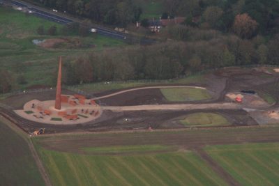 MuseumInternational Bomber Command Centre13 km away
Within 15 km, close and well known first. Numbers match the map.
Your questions on Bardney Abbey
Where is Bardney Abbey?
Bardney Abbey is 400 m northwest of Bardney, Lincolnshire.
What is Bardney Abbey?
Abbey in Bardney, West Lindsey, Lincolnshire, England, UK.
Who runs Bardney Abbey?
Society for Lincolnshire History and Archaeology.
When is the best time to visit Bardney Abbey?
June to September are the warmest months in Bardney, with afternoon highs of 19–22°C (Met Office 1991–2020 averages).
Is Bardney Abbey a listed building?
Yes: scheduled monument.
What else is there to see near Bardney Abbey?
Within 15 km: Lincoln Cathedral (14 km), Lincoln Castle (14 km), Lincoln Museum (14 km) and Kirkstead Abbey (12 km).
Places: OpenStreetMap (© OpenStreetMap contributors, Open Database Licence) and Wikidata (CC0), placed in the ONS 2022 built-up area (Open Government Licence v3.0). Visitor counts are the latest Wikidata gives, with their year.
Photos: each place’s Wikidata image, from Wikimedia Commons under the licence below (our copy, resized).
Photo credits (9)
- Bardney Abbey: Richard Croft, CC BY-SA 2.0, Wikimedia Commons
- Lincoln Cathedral: DrMoschi, CC BY-SA 4.0, Wikimedia Commons
- Lincoln Castle: Dmitrij M, CC BY 3.0, Wikimedia Commons
- Lincoln Museum: John Lord from Edinburgh, Scotland, CC BY 2.0, Wikimedia Commons
- Kirkstead Abbey: Richard Croft, CC BY-SA 2.0, Wikimedia Commons
- Medieval Bishop's Palace: Dave Hitchborne, CC BY-SA 2.0, Wikimedia Commons
- Stainfield Priory: Richard Croft, CC BY-SA 2.0, Wikimedia Commons
- Usher Gallery: Ian Carrington, CC BY-SA 2.0, Wikimedia Commons
- International Bomber Command Centre: Chris, CC BY-SA 2.0, Wikimedia Commons
Contains public sector information licensed under the Open Government Licence v3.0. Contains HM Land Registry data © Crown copyright and database right 2026. Contains OS data © Crown copyright and database right 2026 (ONS boundaries). Northern Ireland: Source: NISRA; contains Land & Property Services data and Ordnance Survey of Northern Ireland information, © Crown copyright, licensed under the Open Government Licence v3.0. Scotland: contains National Records of Scotland data, Registers of Scotland data and SEPA data, © Crown copyright / © SEPA 2025, licensed under the Open Government Licence v3.0.