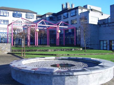
The National Inventory rates Building misc, Barrington Street, Limerick Regional, one of 298 in Dock. Its record dates Building misc, Barrington Street, Limerick to 1840–1860. 234 other places on the record stand within 400 m.
It would appear that the ground floor and the wide entrance to the west were built at the time, or shortly after, that of No. 1 Pery Square, which was constructed in 1838. The oculus adjacent to the entrance porch suggests that the original single-storey building was for the use of No. 1 Pery Square.
From the National Inventory’s appraisal, record 21517181 · CC BY 4.0 · Department of Housing, Local Government and Heritage
The list holds 2, all within 40 km and photographed. “Prison, Crosbie Row, Limerick” in Corbally and King's Island is the nearest, at 1.2 km. At the edge of the list, 14 km away: Adare Castle, Adare.
Questions about Building misc, Barrington Street, Limerick
Is Building misc, Barrington Street, Limerick on the National Inventory?
Yes: rated Regional (record 21517181).
Can you visit Building misc, Barrington Street, Limerick?
It can be seen from the street; whether you can go inside depends on its owner.
When was Building misc, Barrington Street, Limerick built?
Its National Inventory record dates it to 1840–1860.
Is Building misc, Barrington Street, Limerick protected?
Being on the National Inventory or the Sites and Monuments Record is a record, not protection by itself: buildings are protected by their council’s Record of Protected Structures, which each council keeps and no national open list gathers, so this page can’t say which are on it.
Source: National Inventory of Architectural Heritage and Sites and Monuments Record, Department of Housing, Local Government and Heritage (CC BY 4.0); Wikidata (CC0).
Sources: National Inventory of Architectural Heritage (buildingsofireland.ie). Under Creative Commons Attribution 4.0 (CC BY 4.0).
Contains Central Statistics Office (CSO) data, Census 2022, and Tailte Éireann boundaries (CSO Urban Areas, Small Areas, local electoral areas, constituencies), under Creative Commons Attribution 4.0 (CC BY 4.0).


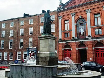 Catholic Church of the Sacred HeartRegional rating (NIAH) · 100 m on