- Address
- 46 Sunday's Well Road, Cork
- Type
- House
- NIAH reg. no.
- 20866061
Hazelhurst
46 Sunday's Well Road, Cork
Many historic buildings are private homes. Please enjoy them from the street.
About Hazelhurst
Hazelhurst is one of 276 buildings in Sunday's Well the National Inventory rates Regional. Hazelhurst dates from 1800–1840. 101 other places on the record stand within 400 m.
A pair of houses, which in common with contemporary houses in this prosperous suburb, was orientated to the south to maximize light and views over the River Lee. It retains noteworthy features including timber sliding sash windows, slate hanging and decorative door surround.
From the National Inventory’s appraisal, record 20866061 · CC BY 4.0 · Department of Housing, Local Government and Heritage
NIAHRead its National Inventory recordThe full description and appraisal, the survey photo and the map · 20866061↗Regional is the National Inventory’s rating for a building of significance in its region; most rated buildings carry it.
Make it a walk: 5 historic places in about 10 minutes
Sunday's Well · about 400 m on foot, as the crow flies


- 1HazelhurstStart here
- 2Rosa VillaRegional rating (NIAH) · 100 m on
- 3Cork City Gaol (prison / jail)National rating (NIAH) · 100 m on
- 4WoodhillRegional rating (NIAH) · 100 m on
- 5Ferry View CottageRegional rating (NIAH) · 100 m on
 Girl DancerRegional rating (NIAH)300 m
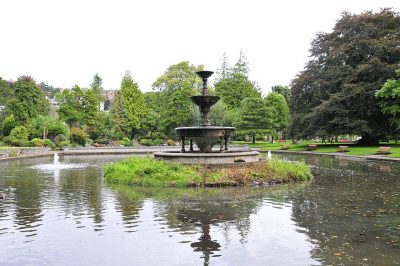 Father Matthew Memorial FountainRegional rating (NIAH)300 mMenton VillasRegional rating (NIAH)300 mCork City Gaol (prison governor's house)Regional rating (NIAH)300 m
 Catholic Church of Our Lady of the RosaryRegional rating (NIAH)300 m
27 within 150 m
Every place on the record within this distance; each opens its own page.
Show the other 9
Recorded houses around Sunday's Well
Closest of all: “House, The Mercy Hospital”, Cork City Centre, 900 m away. Within 40 km, 8 have a photo.


Questions about Hazelhurst
Is Hazelhurst on the National Inventory?
Yes: rated Regional (record 20866061).
Can you visit Hazelhurst?
Many historic buildings are private homes; this one can be seen from the street.
When was Hazelhurst built?
Its National Inventory record dates it to 1800–1840.
Is Hazelhurst protected?
Being on the National Inventory or the Sites and Monuments Record is a record, not protection by itself: buildings are protected by their council’s Record of Protected Structures, which each council keeps and no national open list gathers, so this page can’t say which are on it.
Source: National Inventory of Architectural Heritage and Sites and Monuments Record, Department of Housing, Local Government and Heritage (CC BY 4.0); Wikidata (CC0).
Sources: National Inventory of Architectural Heritage (buildingsofireland.ie). Under Creative Commons Attribution 4.0 (CC BY 4.0).
Contains Central Statistics Office (CSO) data, Census 2022, and Tailte Éireann boundaries (CSO Urban Areas, Small Areas, local electoral areas, constituencies), under Creative Commons Attribution 4.0 (CC BY 4.0).