- Address
- Donnybrook
- Type
- Gate lodge
- NIAH reg. no.
- 20908626
Gate lodge, Donnybrook
Many historic buildings are private homes. Please enjoy them from the street.
About Gate lodge, Donnybrook
Gate lodge, Donnybrook is one of 51 buildings in Douglas the National Inventory rates Regional. Gate lodge, Donnybrook dates from 1800–1840. 16 other places on the record stand within 400 m.
A former gate lodge to Mount Grange, which retains much of its original character. The oversailing eaves anchor the building, while the corner pilasters articulate its form.
From the National Inventory’s appraisal, record 20908626 · CC BY 4.0 · Department of Housing, Local Government and Heritage
NIAHRead its National Inventory recordThe full description and appraisal, the survey photo and the map · 20908626↗Regional is the National Inventory’s rating for a building of significance in its region; most rated buildings carry it.
Make it a walk: 5 historic places in about 15 minutes
Donnybrook, Douglas · about 700 m on foot, as the crow flies


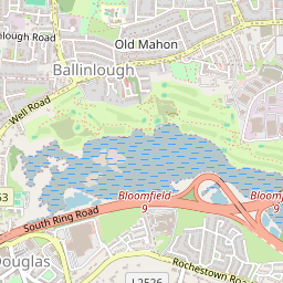
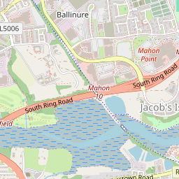


- 1Gate lodge, DonnybrookStart here
- 2Ballybrack House (gates / railings / walls)Regional rating (NIAH) · 100 m on
- 3The RectoryRegional rating (NIAH) · 300 m on
- 4
 St Columba's Roman Catholic ChurchRegional rating (NIAH) · 100 m on
- 5
 St Luke's Church of Ireland ChurchRegional rating (NIAH) · 200 m on
5 within 150 m
Every place on the record within this distance; each opens its own page.
More houses on the record near Douglas
Within 40 km, 8 have a photo. Start with Vernon Mount in Frankfield and Grange, 1.3 km away.


Questions about Gate lodge, Donnybrook
Is Gate lodge, Donnybrook on the National Inventory?
Yes: rated Regional (record 20908626).
Can you visit Gate lodge, Donnybrook?
Many historic buildings are private homes; this one can be seen from the street.
When was Gate lodge, Donnybrook built?
Its National Inventory record dates it to 1800–1840.
Is Gate lodge, Donnybrook protected?
Being on the National Inventory or the Sites and Monuments Record is a record, not protection by itself: buildings are protected by their council’s Record of Protected Structures, which each council keeps and no national open list gathers, so this page can’t say which are on it.
Source: National Inventory of Architectural Heritage and Sites and Monuments Record, Department of Housing, Local Government and Heritage (CC BY 4.0); Wikidata (CC0).
Sources: National Inventory of Architectural Heritage (buildingsofireland.ie). Under Creative Commons Attribution 4.0 (CC BY 4.0).
Contains Central Statistics Office (CSO) data, Census 2022, and Tailte Éireann boundaries (CSO Urban Areas, Small Areas, local electoral areas, constituencies), under Creative Commons Attribution 4.0 (CC BY 4.0).