Where to go near Signes
Only Lavoir is on our list in Signes or within 5 km of its centre. Out of town, Basilique Notre-Dame-de-la-Garde is 39 km away. Within 40 km, the list counts 12, among them 4 attractions and 3 museums.
Starting nearby
At 800 m from the centre, Lavoir is the closest.
The places, mapped
7 places are numbered, in the order below.
Signes is the orange dot; the numbers match the places below. © OpenStreetMap contributors · commune boundary: IGN
How the list breaks down
Other sights number 5, châteaux or heritage sites 5.
Dark: in Signes. Light: the rest, within 40 km of its centre.
Every one of them
First the one in town, then the 12 within 40 km.
Basilique Notre-Dame-de-la-Garde
Basilica located in Bouches-du-Rhône, in France.
Cathédrale Sainte-Marie-Majeure
Cathedral located in Bouches-du-Rhône, in France.
Cathédrale Notre-Dame-de-la-Seds de Toulon
Cathedral located in Var, in France.
Abbaye Saint-Victor de Marseille
Abbey located in Bouches-du-Rhône, France.
Musée des Beaux-Arts de Marseille
Museum in Marseille, France.
Musée d'Histoire de Marseille
History museum in rue Henri-Barbusse Marseille.
What is in or close to Signes comes first, then places within 40 km with an article in both French and English Wikipedia, nearest first.
For a day out
Here are the best known of the 12 within 40 km.
 2ChurchBasilique Notre-Dame-de-la-Garde39 km west, in Marseille 6e
 3AttractionCathédrale Sainte-Marie-Majeure40 km west, in Marseille 2e
 4CathedralCathédrale Notre-Dame-de-la-Seds de Toulon19 km south, in Toulon
 5AbbeyAbbaye Saint-Victor de Marseille40 km west, in Marseille 7e
 6AbbeyAbbaye du Thoronet38 km northeast, in Le ThoronetAttraction7AttractionFNRS-321 km south, in Toulon
 MuseumMusée des Beaux-Arts de Marseille38 km west, in Marseille 4e
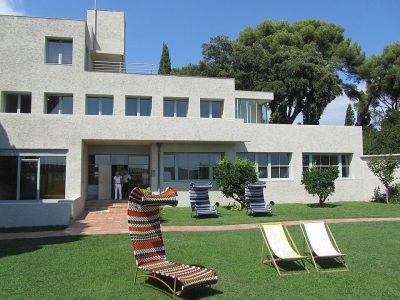 AttractionVilla Noailles28 km southeast, in HyèresMuseumMuseumMusée Cantini39 km west, in Marseille 6e
 MuseumMusée d'Histoire de Marseille39 km west, in Marseille 1erAttractionAttractionPorte d'Aix39 km west, in Marseille 3eFortFortTour royale21 km south, in Toulon
The best known within 40 km, the closest and best known first.
The nearest town with more to see: Toulon →
Common questions about Signes
What is there to see in Signes?
The one place mapped in Signes is Lavoir. We list 1 place in town.
Are there museums in or near Signes?
No museum or gallery is mapped in Signes or within 5 km.
What well-known places are within a day out of Signes?
The nearest with articles in both French and English Wikipedia: Basilique Notre-Dame-de-la-Garde (39 km), Cathédrale Sainte-Marie-Majeure (40 km), Cathédrale Notre-Dame-de-la-Seds de Toulon (19 km), Abbaye Saint-Victor de Marseille (40 km).
How is this list made?
From OpenStreetMap and Wikidata: named museums, galleries, châteaux, abbeys, gardens, zoos, theme parks and other visitor attractions whose mapped point lies inside the commune of Signes, then those in the communes within 5 km of its centre, and well-known places within 40 km. Houses, ruins and gardens need a sign they’re open to visitors; places marked private, closed or disused are left out. The historic-monument link is the Culture ministry’s Mérimée record. A place that isn’t mapped isn’t listed, so this isn’t everything there is to see.
Sources: OpenStreetMap (© OpenStreetMap contributors, ODbL), Wikidata (CC0: descriptions, websites, Wikipedia articles), the Culture ministry’s Mérimée database (Licence Ouverte 2.0), IGN commune boundaries. Distances are from the commune’s centre point.
Photos from Wikimedia Commons, each under its own licence (our copy, resized).
Photo credits (5)
- Basilique Notre-Dame-de-la-Garde: lienyuan lee, CC BY 3.0, Wikimedia Commons
- Cathédrale Sainte-Marie-Majeure: Guiguilacagouille, CC BY-SA 3.0, Wikimedia Commons
- Cathédrale Notre-Dame-de-la-Seds de Toulon: Raimond Spekking, CC BY-SA 4.0, Wikimedia Commons
- Abbaye Saint-Victor de Marseille: Bjs, CC BY-SA 4.0, Wikimedia Commons
- Abbaye du Thoronet: SiefkinDR, Public domain, Wikimedia Commons
Contains public sector information under the Licence Ouverte / Open Licence 2.0 (Etalab): INSEE, DGFiP, the Interior Ministry’s statistics service (SSMSI), the Ministry of Education (DEPP), the Health Ministry’s statistics service (DREES) and the Housing Ministry (Carte des loyers). Commune boundaries: IGN Admin Express.