Out and about near Montredon-des-Corbières
Only Château de Saint-Pierre-des-Clars is on our list in Montredon-des-Corbières or within 5 km of its centre. Head 6.4 km out for Voie Domitienne. Look within 40 km and there are 12, among them 8 attractions and a cathedral.
The nearest one
Château de Saint-Pierre-des-Clars is 2.5 km from the middle of Montredon-des-Corbières.
Getting your bearings
The tiles below match the 7 numbers on the map.
Montredon-des-Corbières is the orange dot; the numbers match the places below. © OpenStreetMap contributors · commune boundary: IGN
What sort of places
Other sights lead the count with 8; 3 are châteaux or heritage sites.
Dark: in Montredon-des-Corbières. Light: the rest, within 40 km of its centre.
Everything to see
One in town leads, with 12 more within 40 km after it.
Voie Domitienne
Roman road linking Italy and Hispania through Gallia Narbonensis.
Cathédrale Saint-Just-et-Saint-Pasteur de Narbonne
Cathedral located in Aude, in France.
Abbaye Sainte-Marie de Fontfroide
Cistercian abbey located near Narbonne, in Aude department of France.
Côte magnétique
Place where the layout of the surrounding land produces an optical illusion, making a slight downhill slope appear to be an uphill slope.
Palais des archevêques de Narbonne
Town hall in Narbonne, France.
Cathédrale Saint-Nazaire-et-Saint-Celse de Béziers
Cathedral located in Hérault, in France.
Musée d'art et d'histoire de Narbonne
Museum in Narbonne, France.
What is in or close to Montredon-des-Corbières comes first, then places within 40 km with an article in both French and English Wikipedia, nearest first.
The history of Montredon-des-Corbières → · Parks and trails in Montredon-des-Corbières →
Out of town
Our picks of the 12 places within 40 km are here, best known first.
 2AttractionVoie Domitienne6.4 km east, in NarbonneCathedral3CathedralCathédrale Saint-Just-et-Saint-Pasteur de Narbonne6.4 km east, in Narbonne
 4AttractionAbbaye Sainte-Marie de Fontfroide7.5 km south, in NarbonneAttraction5AttractionCôte magnétique27 km northwest, in Siran
 6AttractionPalais des archevêques de Narbonne6.4 km east, in NarbonneAttraction7AttractionPont des Marchands6.4 km east, in Narbonne
 ZooRéserve africaine de Sigean14 km south, in SigeanAttractionAttractionCathédrale Saint-Nazaire-et-Saint-Celse de Béziers28 km northeast, in Béziers
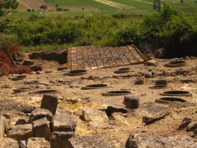 AttractionOppidum d'Ensérune20 km northeast, in Nissan-lez-Enserune
 Art galleryMusée d'art et d'histoire de Narbonne6.4 km east, in NarbonneChâteauChâteauChâteau de Saint-Martin de Toques8.4 km southwest, in BizanetAttractionAttractionPech Maho16 km south, in Sigean
The best known within 40 km, the closest and best known first.
The nearest town with more to see: Narbonne →
What people ask about Montredon-des-Corbières
What is there to see in Montredon-des-Corbières?
The one place mapped in Montredon-des-Corbières is Château de Saint-Pierre-des-Clars. We list 1 place in town.
Are there museums in or near Montredon-des-Corbières?
No museum or gallery is mapped in Montredon-des-Corbières or within 5 km.
What well-known places are within a day out of Montredon-des-Corbières?
The nearest with articles in both French and English Wikipedia: Voie Domitienne (6.4 km), Cathédrale Saint-Just-et-Saint-Pasteur de Narbonne (6.4 km), Abbaye Sainte-Marie de Fontfroide (7.5 km), Côte magnétique (27 km).
How is this list made?
From OpenStreetMap and Wikidata: named museums, galleries, châteaux, abbeys, gardens, zoos, theme parks and other visitor attractions whose mapped point lies inside the commune of Montredon-des-Corbières, then those in the communes within 5 km of its centre, and well-known places within 40 km. Houses, ruins and gardens need a sign they’re open to visitors; places marked private, closed or disused are left out. The historic-monument link is the Culture ministry’s Mérimée record. A place that isn’t mapped isn’t listed, so this isn’t everything there is to see.
Sources: OpenStreetMap (© OpenStreetMap contributors, ODbL), Wikidata (CC0: descriptions, websites, Wikipedia articles), the Culture ministry’s Mérimée database (Licence Ouverte 2.0), IGN commune boundaries. Distances are from the commune’s centre point.
Photos from Wikimedia Commons, each under its own licence (our copy, resized).
Photo credits (3)
- Voie Domitienne: Benoît Strepenne, CC BY 2.5, Wikimedia Commons
- Abbaye Sainte-Marie de Fontfroide: Pinpin 20:15, 10 July 2006 (UTC), CC BY-SA 3.0, Wikimedia Commons
- Palais des archevêques de Narbonne: Didier Descouens, CC BY-SA 4.0, Wikimedia Commons
Contains public sector information under the Licence Ouverte / Open Licence 2.0 (Etalab): INSEE, DGFiP, the Interior Ministry’s statistics service (SSMSI), the Ministry of Education (DEPP), the Health Ministry’s statistics service (DREES) and the Housing Ministry (Carte des loyers). Commune boundaries: IGN Admin Express.