Manoir d'Andigny
Manoir d'Andigny is a château you can visit in Saint-Étienne-de-Chigny. Close by, within 5 km, are 13 more places to see. It was listed in 1992 as a registered historic monument (inscrit, in part).
Château in Saint-Étienne-de-Chigny
In Saint-Étienne-de-Chigny
Manoir d'Andigny is in the commune of Saint-Étienne-de-Chigny, with 13 more places to visit within 5 km. Towns near it ↓
Registered historic monument (inscrit, in part)
Protected as a historic monument since 1992; built in the 15th and 16th centuries (Mérimée record PA00098315). About ↓
Written from OpenStreetMap, Wikidata, the Culture ministry’s Mérimée database and Météo-France 1991–2020 normals.
Month by month
From May to October, Saint-Étienne-de-Chigny sees highs of 17–26°C.
Manoir d'Andigny
Around it, Château de Villandry (3.4 km) comes first on our list.
- Type
- Château
- Protection
- Registered historic monument (inscrit, in part) · 1992
- Built
- 15th and 16th centuries
- Commune
- Saint-Étienne-de-Chigny, Indre-et-Loire
Map of Manoir d'Andigny and nearby
Each numbered point is one of the places listed below; Manoir d'Andigny is the orange one.
© OpenStreetMap contributors · The dashed line is the commune of Saint-Étienne-de-Chigny. · commune boundary: IGN
Towns around Manoir d'Andigny, by distance
Among the 8, Fondettes is the biggest, home to 10,954 people. Every town below has its own grades, prices and places to visit.
- 1Saint-Étienne-de-Chigny
- 2Luynes
- 3Savonnières
- 4Cinq-Mars-la-Pile
- 5Fondettes
- 6Ballan-Miré
- 7Langeais
- 8La Riche
Saint-Étienne-de-Chigny
Luynes
Savonnières
Cinq-Mars-la-Pile
Compare the 8 towns
| Town | Where Manoir d'Andigny is | People |
|---|---|---|
| Saint-Étienne-de-Chigny | It’s in this commune | 1,579 |
| Luynes | 3.6 km northeast of it | 5,062 |
| Savonnières | 4.4 km southeast of it | 3,392 |
| Cinq-Mars-la-Pile | 5.4 km southwest of it | 4,015 |
| Fondettes | 7.7 km northeast of it | 10,954 |
| Ballan-Miré | 7.9 km southeast of it | 8,477 |
| Langeais | 10 km southwest of it | 4,367 |
| La Riche | 11 km east of it | 10,487 |
What else is near Manoir d'Andigny
Within 15 km you can add 5 attractions, 2 châteaux and a church.
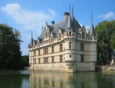 AttractionChâteau d'Azay-le-Rideau13 km south, in Azay-le-Rideau3
 AttractionChâteau de Langeais9.8 km southwest, in Langeais4AttractionAttractionChâteau de Luynes3.2 km northeast, in Luynes5
 AttractionCathédrale Saint-Gatien de Tours14 km east, in Tours6ChâteauChâteauChâteau de Plessis-lès-Tours11 km east, in La Riche7
 ChurchBasilique Saint-Martin de Tours13 km east, in Tours8
 ChâteauChâteau de Candé14 km southeast, in Monts
Within 15 km, close and well known first. Numbers match the map.
Manoir d'Andigny, answered
Where is Manoir d'Andigny?
Manoir d'Andigny is in Saint-Étienne-de-Chigny, in Indre-et-Loire (Centre-Val de Loire).
What is Manoir d'Andigny?
Château.
Is Manoir d'Andigny a historic monument?
Yes: Registered historic monument (inscrit, in part), since 1992, Mérimée record PA00098315.
When is the best time to visit Manoir d'Andigny?
May to October are the warmest months in Saint-Étienne-de-Chigny, with afternoon highs of 17–26°C (Météo-France 1991–2020 normals).
What else is there to see near Manoir d'Andigny?
Within 15 km: Château de Villandry (3.4 km), Château d'Azay-le-Rideau (13 km), Château de Langeais (9.8 km) and Château de Luynes (3.2 km).
Sources: OpenStreetMap (© OpenStreetMap contributors, ODbL), Wikidata (CC0: what it is, its articles, how widely it is covered), the Culture ministry’s Mérimée database (Licence Ouverte 2.0), IGN commune boundaries, Météo-France 1991–2020 normals (Licence Ouverte 2.0).
Photos from Wikimedia Commons, each under its own licence (our copy, resized).
Photo credits (5)
- Château d'Azay-le-Rideau: Manfred Heyde, CC BY-SA 3.0, Wikimedia Commons
- Château de Langeais: Carsten Steger, CC BY-SA 4.0, Wikimedia Commons
- Cathédrale Saint-Gatien de Tours: Miralolotte23, CC BY-SA 3.0, Wikimedia Commons
- Basilique Saint-Martin de Tours: Parsifall, CC BY-SA 3.0, Wikimedia Commons
- Château de Candé: Gilbert Bochenek, Public domain, Wikimedia Commons
Contains public sector information under the Licence Ouverte / Open Licence 2.0 (Etalab): INSEE, DGFiP, the Interior Ministry’s statistics service (SSMSI), the Ministry of Education (DEPP), the Health Ministry’s statistics service (DREES) and the Housing Ministry (Carte des loyers). Commune boundaries: IGN Admin Express.