Fort de Goareva
Among the sights of Île-de-Bréhat is Fort de Goareva. Add any of 3 more places within 5 km to a visit. Worth the trip, Abbaye de Beauport is 7.9 km off.
Fort in Île-de-Bréhat
In Île-de-Bréhat
Fort de Goareva is in the commune of Île-de-Bréhat, with 3 more places to visit within 5 km. Towns near it ↓
Written from OpenStreetMap, Wikidata and Météo-France 1991–2020 normals.
Seasons and weather
Warmest in Île-de-Bréhat are June to September, at 19–21°C.
Fort de Goareva
Fort de Goareva is in Île-de-Bréhat, Côtes-d'Armor.
- Type
- Fort
- Commune
- Île-de-Bréhat, Côtes-d'Armor
Where to find Fort de Goareva
Use the numbers to match each place near Fort de Goareva with the list.
© OpenStreetMap contributors · The dashed line is the commune of Île-de-Bréhat. · commune boundary: IGN
Towns close to Fort de Goareva
Paimpol is the biggest of the 8 bases nearby (7,341 people). All of these towns include it on their pages.
Île-de-Bréhat
Ploubazlanec
Paimpol
Plouézec
Compare the 8 towns
| Town | Where Fort de Goareva is | People |
|---|---|---|
| Île-de-Bréhat | It’s in this commune | 429 |
| Ploubazlanec | 4.4 km southwest of it | 2,932 |
| Paimpol | 7.6 km south of it | 7,341 |
| Plouézec | 10 km south of it | 3,147 |
| Plouha | 19 km south of it | 4,634 |
| La Roche-Jaudy | 20 km southwest of it | 2,629 |
| Penvénan | 21 km west of it | 2,584 |
| Saint-Quay-Portrieux | 24 km southeast of it | 3,224 |
Also near Fort de Goareva
Choose from 18 places within 15 km, such as 4 attractions, 3 châteaux and a church.
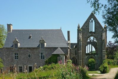 AttractionAbbaye de Beauport7.9 km south, in Paimpol2AttractionAttractionSillon de Talbert6.7 km northwest, in Pleubian3AttractionAttractionMoulin de Craca9 km south, in Plouézec4AttractionAttractionLes verreries de Bréhat100 m west, in Île-de-Bréhat5ChurchChurchAncienne église de Paimpol7.3 km southwest, in Paimpol6ChâteauChâteauManoir de Kerloury7.7 km southwest, in Paimpol7ChâteauChâteauManoir du Grand-Pontébar8.1 km southwest, in Paimpol8ChâteauChâteauManoir de Kerhos13 km west, in Kerbors
Within 15 km, close and well known first. Numbers match the map.
Questions before you go
Where is Fort de Goareva?
Fort de Goareva is in Île-de-Bréhat, in Côtes-d'Armor (Brittany).
What is Fort de Goareva?
Fort.
When is the best time to visit Fort de Goareva?
June to September are the warmest months in Île-de-Bréhat, with afternoon highs of 19–21°C (Météo-France 1991–2020 normals).
What else is there to see near Fort de Goareva?
Within 15 km: Abbaye de Beauport (7.9 km), Sillon de Talbert (6.7 km), Moulin de Craca (9 km) and Les verreries de Bréhat (100 m).
Sources: OpenStreetMap (© OpenStreetMap contributors, ODbL), Wikidata (CC0: what it is, its articles, how widely it is covered), the Culture ministry’s Mérimée database (Licence Ouverte 2.0), IGN commune boundaries, Météo-France 1991–2020 normals (Licence Ouverte 2.0).
Photos from Wikimedia Commons, each under its own licence (our copy, resized).
Photo credits (1)
- Abbaye de Beauport: JLPC, CC BY-SA 3.0, Wikimedia Commons
Contains public sector information under the Licence Ouverte / Open Licence 2.0 (Etalab): INSEE, DGFiP, the Interior Ministry’s statistics service (SSMSI), the Ministry of Education (DEPP), the Health Ministry’s statistics service (DREES) and the Housing Ministry (Carte des loyers). Commune boundaries: IGN Admin Express.