Fort de Charenton
Fort de Charenton is a fort in Maisons-Alfort. A short trip away is Musée du Louvre, 8.8 km off, the first of 2,142 within 15 km. Readers can find it on Wikipedia in 4 languages.
Fort in Maisons-Alfort
One of the best-known places to visit in France
#2,141 of the 37,318 museums, châteaux, gardens and other attractions we list in France, by how widely it is covered (4 Wikipedia and sister-site articles). About ↓
In Maisons-Alfort
Fort de Charenton is in the commune of Maisons-Alfort, with 200 more places to visit within 5 km. Towns near it ↓
Written from OpenStreetMap, Wikidata and Météo-France 1991–2020 normals.
The weather, month by month
Warm weather in Maisons-Alfort runs April to October, with highs of 17–27°C.
Fort de Charenton
Fort in Maisons-Alfort, France.
Fort de Charenton is in Maisons-Alfort, Val-de-Marne.
- Type
- Fort
- Covered in
- 4 Wikipedia and sister-site articles
- Commune
- Maisons-Alfort, Val-de-Marne
The area around Fort de Charenton
The orange dot is Fort de Charenton; the numbers are the places near it, as listed below.
© OpenStreetMap contributors · The dashed line is the commune of Maisons-Alfort. · commune boundary: IGN
Towns close to Fort de Charenton
The biggest base of the 8 is Vitry-sur-Seine (93,963 people). Every one of these towns counts it as a place to visit.
- 1Maisons-Alfort
- 2Alfortville
- 3Saint-Maurice
- 4Charenton-le-Pont
- 5Joinville-le-Pont
- 6Ivry-sur-Seine
- 7Créteil
- 8Vitry-sur-Seine
Maisons-Alfort
Alfortville
Saint-Maurice
Charenton-le-Pont
Compare the 8 towns
| Town | Where Fort de Charenton is | People |
|---|---|---|
| Maisons-Alfort | It’s in this commune | 56,799 |
| Alfortville | 1 km southwest of it | 45,531 |
| Saint-Maurice | 1.2 km northeast of it | 14,506 |
| Charenton-le-Pont | 2.1 km northwest of it | 28,830 |
| Joinville-le-Pont | 3.3 km east of it | 20,525 |
| Ivry-sur-Seine | 3.4 km west of it | 65,064 |
| Créteil | 3.6 km southeast of it | 93,397 |
| Vitry-sur-Seine | 3.7 km southwest of it | 93,963 |
Next door to Fort de Charenton
Also close at hand are 4 attractions, 3 museums and a garden, among 2,142 within 15 km.
 AttractionTour Eiffel11 km northwest, in Paris 7e3
 AttractionCathédrale Notre-Dame de Paris7.6 km northwest, in Paris 4e4
 MuseumMusée d'Orsay9.4 km northwest, in Paris 7e5GardenGardenBois de Vincennes2.2 km north, in Paris 12e6
 AttractionCimetière du Père-Lachaise6.4 km northwest, in Paris 20e7
 AttractionAvenue des Champs-Élysées11 km northwest, in Paris 8e8
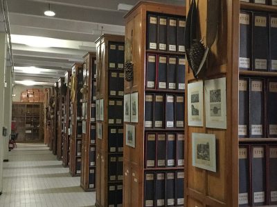 MuseumHerbier6.3 km northwest, in Paris 5e
Within 15 km, close and well known first. Numbers match the map.
Visiting Fort de Charenton: the answers
Where is Fort de Charenton?
Fort de Charenton is in Maisons-Alfort, in Val-de-Marne (Île-de-France).
What is Fort de Charenton?
Fort in Maisons-Alfort, France.
How well known is Fort de Charenton?
Fort de Charenton has 4 Wikipedia and sister-site articles in different languages: #2,141 of the 37,318 French places we list.
When is the best time to visit Fort de Charenton?
April to October are the warmest months in Maisons-Alfort, with afternoon highs of 17–27°C (Météo-France 1991–2020 normals).
What else is there to see near Fort de Charenton?
Within 15 km: Musée du Louvre (8.8 km), Tour Eiffel (11 km), Cathédrale Notre-Dame de Paris (7.6 km) and Musée d'Orsay (9.4 km).
Sources: OpenStreetMap (© OpenStreetMap contributors, ODbL), Wikidata (CC0: what it is, its articles, how widely it is covered), the Culture ministry’s Mérimée database (Licence Ouverte 2.0), IGN commune boundaries, Météo-France 1991–2020 normals (Licence Ouverte 2.0).
Photos from Wikimedia Commons, each under its own licence (our copy, resized).
Photo credits (6)
- Tour Eiffel: Benh LIEU SONG, Public domain, Wikimedia Commons
- Cathédrale Notre-Dame de Paris: P e z i, CC BY-SA 3.0, Wikimedia Commons
- Musée d'Orsay: Cheng-en Cheng from Taichung City, Taiwan, CC BY-SA 2.0, Wikimedia Commons
- Cimetière du Père-Lachaise: Connie Ma from Chicago, United States of America, CC BY-SA 2.0, Wikimedia Commons
- Avenue des Champs-Élysées: SoWhat, CC BY-SA 2.0, Wikimedia Commons
- Herbier: DIST Lyon1, CC BY-SA 4.0, Wikimedia Commons
Contains public sector information under the Licence Ouverte / Open Licence 2.0 (Etalab): INSEE, DGFiP, the Interior Ministry’s statistics service (SSMSI), the Ministry of Education (DEPP), the Health Ministry’s statistics service (DREES) and the Housing Ministry (Carte des loyers). Commune boundaries: IGN Admin Express.