Château de Mongauger
Set in Saint-Épain is Château de Mongauger. Close by, within 5 km, are 3 more places to see. Château d'Azay-le-Rideau, 14 km off, heads what is near.
Château in Saint-Épain
In Saint-Épain
Château de Mongauger is in the commune of Saint-Épain, with 3 more places to visit within 5 km. Towns near it ↓
Written from OpenStreetMap, Wikidata and Météo-France 1991–2020 normals.
Month by month in Saint-Épain
The warmest stretch in Saint-Épain is May to October, at 17–26°C in the afternoon.
Château de Mongauger
Château de Mongauger is in Saint-Épain, Indre-et-Loire.
- Type
- Château
- Commune
- Saint-Épain, Indre-et-Loire
Getting to Château de Mongauger
Use the numbers to match each place near Château de Mongauger with the list.
© OpenStreetMap contributors · The dashed line is the commune of Saint-Épain. · commune boundary: IGN
Towns a short way from Château de Mongauger
Largest of the 8 is Monts, home to 8,080. All of these towns include it on their pages.
- 1Saint-Épain
- 2Sainte-Maure-de-Touraine
- 3Artannes-sur-Indre
- 4Sorigny
- 5Azay-le-Rideau
- 6Monts
- 7Saint-Branchs
- 8Montbazon
Saint-Épain
Sainte-Maure-de-Touraine
Artannes-sur-Indre
Sorigny
Compare the 8 towns
| Town | Where Château de Mongauger is | People |
|---|---|---|
| Saint-Épain | It’s in this commune | 1,471 |
| Sainte-Maure-de-Touraine | 6.1 km southeast of it | 4,092 |
| Artannes-sur-Indre | 14 km north of it | 2,795 |
| Sorigny | 14 km northeast of it | 2,938 |
| Azay-le-Rideau | 15 km northwest of it | 3,438 |
| Monts | 16 km northeast of it | 8,080 |
| Saint-Branchs | 18 km northeast of it | 2,637 |
| Montbazon | 18 km northeast of it | 4,874 |
Close to Château de Mongauger
Nearby, 58 places within 15 km include 2 attractions, 2 museums and 2 churches.
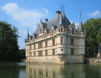 AttractionChâteau d'Azay-le-Rideau14 km northwest, in Azay-le-Rideau2MuseumMuseumChâteau de Saché11 km north, in Saché3ChurchChurchÉglise Saint-Épain de Saint-Épain2.3 km west, in Saint-Épain4MuseumMuseumChâteau de Sainte-Maure-de-Touraine6 km southeast, in Sainte-Maure-de-Touraine5ChâteauChâteauChâteau de Brou3 km south, in Noyant-de-Touraine6AttractionAttractionPierre Percée9.2 km south, in Draché7ChâteauChâteauChâteau de Crissay6.1 km west, in Crissay-sur-Manse8ChurchChurchÉglise Saint-Gilles de L'Île-Bouchard11 km west, in L'Île-Bouchard
Within 15 km, close and well known first. Numbers match the map.
Visiting Château de Mongauger: the answers
Where is Château de Mongauger?
Château de Mongauger is in Saint-Épain, in Indre-et-Loire (Centre-Val de Loire).
What is Château de Mongauger?
Château.
When is the best time to visit Château de Mongauger?
May to October are the warmest months in Saint-Épain, with afternoon highs of 17–26°C (Météo-France 1991–2020 normals).
What else is there to see near Château de Mongauger?
Within 15 km: Château d'Azay-le-Rideau (14 km), Château de Saché (11 km), Église Saint-Épain de Saint-Épain (2.3 km) and Château de Sainte-Maure-de-Touraine (6 km).
Sources: OpenStreetMap (© OpenStreetMap contributors, ODbL), Wikidata (CC0: what it is, its articles, how widely it is covered), the Culture ministry’s Mérimée database (Licence Ouverte 2.0), IGN commune boundaries, Météo-France 1991–2020 normals (Licence Ouverte 2.0).
Photos from Wikimedia Commons, each under its own licence (our copy, resized).
Photo credits (1)
- Château d'Azay-le-Rideau: Manfred Heyde, CC BY-SA 3.0, Wikimedia Commons
Contains public sector information under the Licence Ouverte / Open Licence 2.0 (Etalab): INSEE, DGFiP, the Interior Ministry’s statistics service (SSMSI), the Ministry of Education (DEPP), the Health Ministry’s statistics service (DREES) and the Housing Ministry (Carte des loyers). Commune boundaries: IGN Admin Express.