Château de Maureilhan
In Maureilhan stands Château de Maureilhan. Within 5 km there are 2 more places to visit. It was listed in 1980 as a registered historic monument (inscrit, in part).
Château in Maureilhan
In Maureilhan
Château de Maureilhan is in the commune of Maureilhan, with 2 more places to visit within 5 km. Towns near it ↓
Registered historic monument (inscrit, in part)
Protected as a historic monument since 1980; built in the 14th, 16th and 17th centuries (Mérimée record PA00103505). About ↓
Written from OpenStreetMap, Wikidata, the Culture ministry’s Mérimée database and Météo-France 1991–2020 normals.
The best months to visit
The warmest afternoons in Maureilhan run April to October, at 19–31°C.
Château de Maureilhan
For a second stop, Cathédrale Saint-Nazaire-et-Saint-Celse de Béziers is 7.5 km away.
- Type
- Château
- Protection
- Registered historic monument (inscrit, in part) · 1980
- Built
- 14th, 16th and 17th centuries
- Commune
- Maureilhan, Hérault
Where to find Château de Maureilhan
Orange: Château de Maureilhan.
© OpenStreetMap contributors · Numbers: the places near it, as listed below. The dashed line is the commune of Maureilhan. · commune boundary: IGN
Towns around Château de Maureilhan, by distance
Cazouls-lès-Béziers, with 5,261 people, is the largest of the 8. Every one of these towns counts it as a place to visit.
Maureilhan
Montady
Maraussan
Cazouls-lès-Béziers
Compare the 8 towns
| Town | Where Château de Maureilhan is | People |
|---|---|---|
| Maureilhan | It’s in this commune | 2,495 |
| Montady | 2.6 km south of it | 3,990 |
| Maraussan | 3.1 km east of it | 4,789 |
| Cazouls-lès-Béziers | 4 km north of it | 5,261 |
| Lignan-sur-Orb | 4.9 km northeast of it | 3,227 |
| Colombiers | 5.6 km south of it | 2,814 |
| Puisserguier | 6.5 km west of it | 3,078 |
| Capestang | 7 km southwest of it | 3,514 |
Combine it with these
Choose from 52 places within 15 km, such as 6 attractions, a gallery and a church.
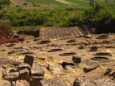 AttractionOppidum d'Ensérune5.5 km south, in Nissan-lez-Enserune3AttractionAttractionPont Vieux de Béziers7.4 km east, in Béziers4AttractionAttractionÉcluses de Fonseranes7.1 km southeast, in Béziers5
 Art galleryMusée des Beaux-Arts de Béziers7.6 km east, in Béziers6AttractionAttractionAbbaye Sainte-Marie de Fontcaude8.4 km northwest, in Cazedarnes7AttractionAttractionChâteau des archevêques de Narbonne6.9 km southwest, in Capestang8ChurchChurchÉglise de la Madeleine de Béziers7.7 km east, in Béziers
Within 15 km, close and well known first. Numbers match the map.
Questions people have about Château de Maureilhan
Where is Château de Maureilhan?
Château de Maureilhan is in Maureilhan, in Hérault (Occitanie).
What is Château de Maureilhan?
Château.
Is Château de Maureilhan a historic monument?
Yes: Registered historic monument (inscrit, in part), since 1980, Mérimée record PA00103505.
When is the best time to visit Château de Maureilhan?
April to October are the warmest months in Maureilhan, with afternoon highs of 19–31°C (Météo-France 1991–2020 normals).
What else is there to see near Château de Maureilhan?
Within 15 km: Cathédrale Saint-Nazaire-et-Saint-Celse de Béziers (7.5 km), Oppidum d'Ensérune (5.5 km), Pont Vieux de Béziers (7.4 km) and Écluses de Fonseranes (7.1 km).
Sources: OpenStreetMap (© OpenStreetMap contributors, ODbL), Wikidata (CC0: what it is, its articles, how widely it is covered), the Culture ministry’s Mérimée database (Licence Ouverte 2.0), IGN commune boundaries, Météo-France 1991–2020 normals (Licence Ouverte 2.0).
Photos from Wikimedia Commons, each under its own licence (our copy, resized).
Photo credits (2)
- Oppidum d'Ensérune: classe unique St-Sulpice-des-Rivoires Isère - FRANCE, CC BY-SA 3.0, Wikimedia Commons
- Musée des Beaux-Arts de Béziers: Romain Bréget, CC BY-SA 3.0, Wikimedia Commons
Contains public sector information under the Licence Ouverte / Open Licence 2.0 (Etalab): INSEE, DGFiP, the Interior Ministry’s statistics service (SSMSI), the Ministry of Education (DEPP), the Health Ministry’s statistics service (DREES) and the Housing Ministry (Carte des loyers). Commune boundaries: IGN Admin Express.