Château de la Filotière
Visitors to Longuenée-en-Anjou can see Château de la Filotière. The surrounding 5 km hold 7 more places to visit. Top of the list nearby is Château d'Angers, 10 km away.
Château in Longuenée-en-Anjou
In Longuenée-en-Anjou
Château de la Filotière is in the commune of Longuenée-en-Anjou, with 7 more places to visit within 5 km. Towns near it ↓
Written from OpenStreetMap, Wikidata and Météo-France 1991–2020 normals.
Seasons in Longuenée-en-Anjou
If warmth matters, go May to October: Longuenée-en-Anjou reaches 17–26°C.
Château de la Filotière
Château de la Filotière is in Longuenée-en-Anjou, Maine-et-Loire.
- Type
- Château
- Commune
- Longuenée-en-Anjou, Maine-et-Loire
The way to Château de la Filotière
Find Château de la Filotière in orange; each number is a place listed below.
© OpenStreetMap contributors · The dashed line is the commune of Longuenée-en-Anjou. · commune boundary: IGN
The nearest towns to Château de la Filotière
The biggest base of the 8 is Avrillé (15,251 people). Pick a base: each town is a page of its own, with what else there is to see.
- 1Longuenée-en-Anjou
- 2Saint-Lambert-la-Potherie
- 3Montreuil-Juigné
- 4Beaucouzé
- 5Saint-Léger-de-Linières
- 6Avrillé
- 7Bécon-les-Granits
- 8Bouchemaine
Longuenée-en-Anjou
Saint-Lambert-la-Potherie
Montreuil-Juigné
Beaucouzé
Compare the 8 towns
| Town | Where Château de la Filotière is | People |
|---|---|---|
| Longuenée-en-Anjou | It’s in this commune | 6,571 |
| Saint-Lambert-la-Potherie | 3.7 km south of it | 2,974 |
| Montreuil-Juigné | 5.4 km east of it | 7,808 |
| Beaucouzé | 5.9 km southeast of it | 5,732 |
| Saint-Léger-de-Linières | 6.2 km south of it | 3,866 |
| Avrillé | 6.9 km east of it | 15,251 |
| Bécon-les-Granits | 9.1 km west of it | 2,811 |
| Bouchemaine | 9.9 km southeast of it | 6,580 |
More to see nearby
A visit can add 2 attractions, 2 châteaux and a cathedral, from 168 places within 15 km.
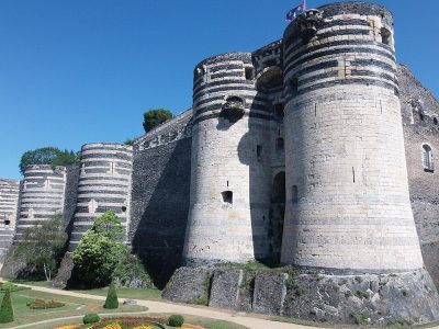 AttractionChâteau d'Angers10 km southeast, in Angers2
 CathedralCathédrale Saint-Maurice d'Angers11 km southeast, in Angers3AttractionAttractionChâteau du Plessis-Bourré14 km northeast, in Écuillé4
 ChâteauChâteau de Serrant12 km southwest, in Saint-Georges-sur-Loire5
 ChâteauChâteau du Plessis-Macé3.3 km north, in Longuenée-en-Anjou6
 Theme parkTerra Botanica8.4 km east, in Angers7
 MuseumMusée des Beaux-Arts d'Angers11 km southeast, in Angers8GardenGardenJardin des plantes d'Angers11 km southeast, in Angers
Within 15 km, close and well known first. Numbers match the map.
Château de la Filotière: what to know
Where is Château de la Filotière?
Château de la Filotière is in Longuenée-en-Anjou, in Maine-et-Loire (Pays de la Loire).
What is Château de la Filotière?
Château.
When is the best time to visit Château de la Filotière?
May to October are the warmest months in Longuenée-en-Anjou, with afternoon highs of 17–26°C (Météo-France 1991–2020 normals).
What else is there to see near Château de la Filotière?
Within 15 km: Château d'Angers (10 km), Cathédrale Saint-Maurice d'Angers (11 km), Château du Plessis-Bourré (14 km) and Château de Serrant (12 km).
Sources: OpenStreetMap (© OpenStreetMap contributors, ODbL), Wikidata (CC0: what it is, its articles, how widely it is covered), the Culture ministry’s Mérimée database (Licence Ouverte 2.0), IGN commune boundaries, Météo-France 1991–2020 normals (Licence Ouverte 2.0).
Photos from Wikimedia Commons, each under its own licence (our copy, resized).
Photo credits (6)
- Château d'Angers: Nataloche, CC BY-SA 4.0, Wikimedia Commons
- Cathédrale Saint-Maurice d'Angers: Denis Pithon, CC BY-SA 3.0, Wikimedia Commons
- Château de Serrant: Manfred Heyde, CC BY-SA 3.0, Wikimedia Commons
- Château du Plessis-Macé: Manfred Heyde, CC BY-SA 3.0, Wikimedia Commons
- Terra Botanica: Terra Botanica, CC BY-SA 4.0, Wikimedia Commons
- Musée des Beaux-Arts d'Angers: Selbymay, CC BY-SA 3.0, Wikimedia Commons
Contains public sector information under the Licence Ouverte / Open Licence 2.0 (Etalab): INSEE, DGFiP, the Interior Ministry’s statistics service (SSMSI), the Ministry of Education (DEPP), the Health Ministry’s statistics service (DREES) and the Housing Ministry (Carte des loyers). Commune boundaries: IGN Admin Express.