Château de la Carte
Among the sights of Ballan-Miré is Château de la Carte. Nearby, 18 more places to visit are within 5 km. Close by, Château de Villandry is 8 km away.
Château in Ballan-Miré
In Ballan-Miré
Château de la Carte is in the commune of Ballan-Miré, with 18 more places to visit within 5 km. Towns near it ↓
Written from OpenStreetMap, Wikidata and Météo-France 1991–2020 normals.
The seasons here
The warmest afternoons in Ballan-Miré run May to October, at 17–26°C.
Château de la Carte
Château de la Carte is in Ballan-Miré, Indre-et-Loire.
- Type
- Château
- Commune
- Ballan-Miré, Indre-et-Loire
Around Château de la Carte, mapped
Château de la Carte is in orange, with the places near it numbered as below.
© OpenStreetMap contributors · The dashed line is the commune of Ballan-Miré. · commune boundary: IGN
Where people come from
Joué-lès-Tours, with 38,423 people, is the largest of the 8. Its own town leads; the rest list it too, closest first.
- 1Ballan-Miré
- 2Joué-lès-Tours
- 3Savonnières
- 4Monts
- 5La Riche
- 6Chambray-lès-Tours
- 7Artannes-sur-Indre
- 8Fondettes
Ballan-Miré
Joué-lès-Tours
Savonnières
Monts
Compare the 8 towns
| Town | Where Château de la Carte is | People |
|---|---|---|
| Ballan-Miré | It’s in this commune | 8,477 |
| Joué-lès-Tours | 3.5 km northeast of it | 38,423 |
| Savonnières | 4.8 km west of it | 3,392 |
| Monts | 6.3 km south of it | 8,080 |
| La Riche | 6.5 km northeast of it | 10,487 |
| Chambray-lès-Tours | 6.5 km east of it | 12,720 |
| Artannes-sur-Indre | 6.9 km south of it | 2,795 |
| Fondettes | 7.8 km north of it | 10,954 |
Next door to Château de la Carte
Our list has 162 more within 15 km, among them 4 attractions, 2 châteaux and a church.
 AttractionCathédrale Saint-Gatien de Tours8.9 km northeast, in Tours3
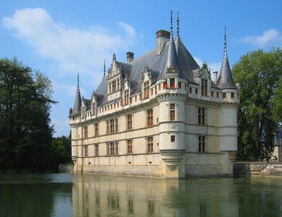 AttractionChâteau d'Azay-le-Rideau14 km southwest, in Azay-le-Rideau4
 ChâteauChâteau de Candé5.2 km southeast, in Monts5ChâteauChâteauChâteau de Plessis-lès-Tours6.3 km northeast, in La Riche6
 ChurchBasilique Saint-Martin de Tours8.1 km northeast, in Tours7MuseumMuseumChâteau de Saché11 km southwest, in Saché8AttractionAttractionChâteau de Luynes7.8 km northwest, in Luynes
Within 15 km, close and well known first. Numbers match the map.
Quick answers on Château de la Carte
Where is Château de la Carte?
Château de la Carte is in Ballan-Miré, in Indre-et-Loire (Centre-Val de Loire).
What is Château de la Carte?
Château.
When is the best time to visit Château de la Carte?
May to October are the warmest months in Ballan-Miré, with afternoon highs of 17–26°C (Météo-France 1991–2020 normals).
What else is there to see near Château de la Carte?
Within 15 km: Château de Villandry (8 km), Cathédrale Saint-Gatien de Tours (8.9 km), Château d'Azay-le-Rideau (14 km) and Château de Candé (5.2 km).
Sources: OpenStreetMap (© OpenStreetMap contributors, ODbL), Wikidata (CC0: what it is, its articles, how widely it is covered), the Culture ministry’s Mérimée database (Licence Ouverte 2.0), IGN commune boundaries, Météo-France 1991–2020 normals (Licence Ouverte 2.0).
Photos from Wikimedia Commons, each under its own licence (our copy, resized).
Photo credits (4)
- Cathédrale Saint-Gatien de Tours: Miralolotte23, CC BY-SA 3.0, Wikimedia Commons
- Château d'Azay-le-Rideau: Manfred Heyde, CC BY-SA 3.0, Wikimedia Commons
- Château de Candé: Gilbert Bochenek, Public domain, Wikimedia Commons
- Basilique Saint-Martin de Tours: Parsifall, CC BY-SA 3.0, Wikimedia Commons
Contains public sector information under the Licence Ouverte / Open Licence 2.0 (Etalab): INSEE, DGFiP, the Interior Ministry’s statistics service (SSMSI), the Ministry of Education (DEPP), the Health Ministry’s statistics service (DREES) and the Housing Ministry (Carte des loyers). Commune boundaries: IGN Admin Express.