Château de Buzignargues
Buzignargues counts Château de Buzignargues among its places to visit. Close by, within 5 km, are 3 more places to see. Since 2010 it has been a registered historic monument (inscrit).
Château in Buzignargues
In Buzignargues
Château de Buzignargues is in the commune of Buzignargues, with 3 more places to visit within 5 km. Towns near it ↓
Registered historic monument (inscrit)
Protected as a historic monument since 2010; built in the 17th century (Mérimée record PA34000081). About ↓
Written from OpenStreetMap, Wikidata, the Culture ministry’s Mérimée database and Météo-France 1991–2020 normals.
Weather by the month
Warm weather in Buzignargues runs April to October, with highs of 20–32°C.
Château de Buzignargues
A drive of 13 km reaches Pont Ambroix.
- Type
- Château
- Protection
- Registered historic monument (inscrit) · 2010
- Built
- 17th century
- Commune
- Buzignargues, Hérault
Château de Buzignargues at a glance
On this map, Château de Buzignargues is orange and its neighbours are numbered.
© OpenStreetMap contributors · The dashed line is the commune of Buzignargues. · commune boundary: IGN
Towns a short way from Château de Buzignargues
Among the 8, Castries is the biggest, home to 6,883 people. The commune it is in, then the towns of 2,500+ within 25 km.
- 1Buzignargues
- 2Saint-Drézéry
- 3Restinclières
- 4Sommières
- 5Sussargues
- 6Castries
- 7Saint-Mathieu-de-Tréviers
- 8Saint-Brès
Buzignargues
Saint-Drézéry
Restinclières
Sommières
Compare the 8 towns
| Town | Where Château de Buzignargues is | People |
|---|---|---|
| Buzignargues | It’s in this commune | 378 |
| Saint-Drézéry | 5 km southwest of it | 3,006 |
| Restinclières | 6 km southeast of it | 2,612 |
| Sommières | 6.6 km east of it | 5,073 |
| Sussargues | 6.7 km south of it | 2,840 |
| Castries | 11 km south of it | 6,883 |
| Saint-Mathieu-de-Tréviers | 11 km west of it | 4,979 |
| Saint-Brès | 12 km south of it | 3,623 |
Each has its own grades, prices and things to do.
Also near Château de Buzignargues
Within 15 km are 56 places, among them 4 châteaux, 2 museums and an archaeological site.
 Archaeological sitePont Ambroix13 km southeast, in Gallargues-le-Montueux2MuseumMuseumAmbrussum13 km southeast, in Villetelle3
 ChâteauChâteau de Castries11 km south, in Castries4
 AttractionChâteau de Montferrand13 km west, in Saint-Mathieu-de-Tréviers5MuseumMuseumLouis Médard15 km southeast, in Lunel6
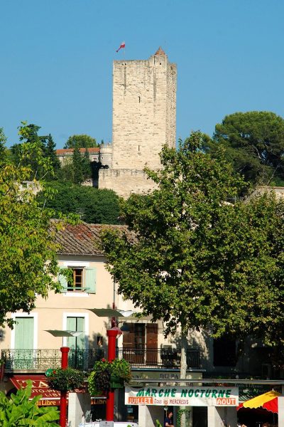 ChâteauChâteau de Sommières7.1 km east, in Sommières7
 ChâteauChâteau d'Aubais11 km east, in Aubais8ChâteauChâteauChâteau d'Assas12 km southwest, in Assas
Within 15 km, close and well known first. Numbers match the map.
Visiting Château de Buzignargues: the answers
Where is Château de Buzignargues?
Château de Buzignargues is in Buzignargues, in Hérault (Occitanie).
What is Château de Buzignargues?
Château.
Is Château de Buzignargues a historic monument?
Yes: Registered historic monument (inscrit), since 2010, Mérimée record PA34000081.
When is the best time to visit Château de Buzignargues?
April to October are the warmest months in Buzignargues, with afternoon highs of 20–32°C (Météo-France 1991–2020 normals).
What else is there to see near Château de Buzignargues?
Within 15 km: Pont Ambroix (13 km), Ambrussum (13 km), Château de Castries (11 km) and Château de Montferrand (13 km).
Sources: OpenStreetMap (© OpenStreetMap contributors, ODbL), Wikidata (CC0: what it is, its articles, how widely it is covered), the Culture ministry’s Mérimée database (Licence Ouverte 2.0), IGN commune boundaries, Météo-France 1991–2020 normals (Licence Ouverte 2.0).
Photos from Wikimedia Commons, each under its own licence (our copy, resized).
Photo credits (5)
- Pont Ambroix: Xabi Rome-Hérault, CC BY 3.0, Wikimedia Commons
- Château de Castries: Daniel VILLAFRUELA ., CC BY-SA 4.0, Wikimedia Commons
- Château de Montferrand: yselzner, CC BY-SA 3.0, Wikimedia Commons
- Château de Sommières: EmDee, CC BY-SA 3.0, Wikimedia Commons
- Château d'Aubais: Daniel VILLAFRUELA ., CC BY-SA 4.0, Wikimedia Commons
Contains public sector information under the Licence Ouverte / Open Licence 2.0 (Etalab): INSEE, DGFiP, the Interior Ministry’s statistics service (SSMSI), the Ministry of Education (DEPP), the Health Ministry’s statistics service (DREES) and the Housing Ministry (Carte des loyers). Commune boundaries: IGN Admin Express.