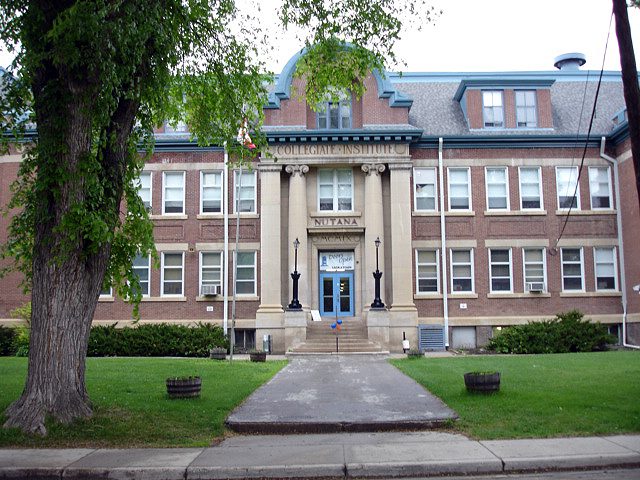
Nutana Collegiate
411 11th Street E · Saskatoon · S7N 0E9 · Saskatoon SD 13
Of the 14 secondary schools in or near Buena Vista (within 3 km), this is Nutana Collegiate. Every school in and around Buena Vista →
What stands out about Nutana Collegiate
- Public and English-language, under Saskatoon SD 13.
Why Nutana Collegiate has no results band
Nutana Collegiate can’t be placed among its province’s schools: the province publishes no results school by school.
Buena Vista goes without a School Grade for the same reason.
Getting a place at Nutana Collegiate
No application round, no lottery: the address fixes the school, and the board handles the paperwork.
The provinces’ education acts and the boards’ own admission policies; check with the board for a given address.
Side by side with the nearest secondary schools
Its level’s nearest schools, measured as the crow flies.
| School | System | Language | Away |
|---|---|---|---|
| Nutana Collegiate | English public | English | |
| Oskayak High School | English public | English | 0.4 km |
| Bishop Murray High School - CNYC | English public | English | 1.5 km |
| Bishop Murray High School - FSP | English public | English | 1.5 km |
| Aden Bowman Collegiate | English public | English | 1.7 km |
| Bedford Road Collegiate | English public | English | 2.1 km |
| E.D. Feehan Catholic High School | English public | English | 2.5 km |
Secondary schools near Nutana Collegiate
Nearest first, as the crow flies, up to 25 km. Each school’s own admission policy decides who gets a place.
Questions about Nutana Collegiate
Who runs Nutana Collegiate?
Nutana Collegiate belongs to Saskatoon SD 13 (English public).
What language does Nutana Collegiate teach in?
English.
How do pupils get a place at Nutana Collegiate?
Contact the board: it names the school for your address and takes the registration.
Which schools of the same kind are near Nutana Collegiate?
The closest schools are Oskayak High School (0.4 km), Bishop Murray High School - CNYC (1.5 km) and Bishop Murray High School - FSP (1.5 km).
Sources: Statistics Canada, Open Database of Educational Facilities v2.1 (2019–22) · map tiles © OpenStreetMap contributors. Under the Statistics Canada Open Licence.
Adapted from Statistics Canada (Census of Population 2021, population estimates 2025, 2021 census boundaries) under the Statistics Canada Open Licence; this does not constitute an endorsement by Statistics Canada. Neighbourhood names in some cities © OpenStreetMap contributors (ODbL).