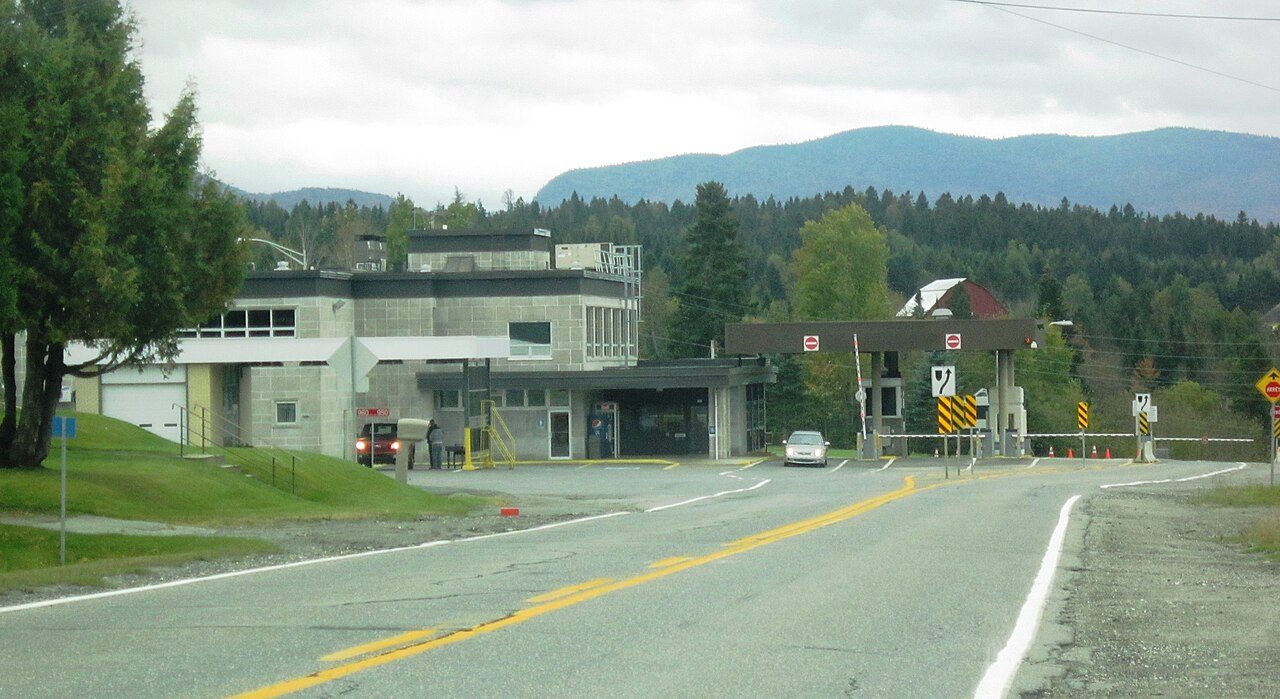
Border Crossing Facility
In French: Poste frontalier de Stanhope
Also known as Customs Building
Route 147, Coaticook
About Border Crossing Facility
Border Crossing Facility is the one Recognized Federal Heritage Building in Coaticook. Border Crossing Facility went up in 1954–1956. Its design is credited to J.F. DeBelleval.
The Border Crossing Facility, also known as the Customs Building, is located at the Canadian border along Highway 147 in Stanhope, Québec. The sleek, geometrical International Style design of the building consists of a two-storey, flat-roofed structure composed of horizontal and vertical forms. A variety of window openings, asymmetrically placed to correspond to interior functions, contribute to a streamlined appearance, as do the smooth, granite clad surface planes that define the building’s facades. The designation is confined to the footprint of the building.
From the Canadian Register of Historic Places, Border Crossing Facility · Open Government Licence – Canada · in the register’s words, not edited
Federal heritage buildings are Classified or Recognized; this one is Recognized.
Finding Border Crossing Facility
Coaticook


Its nearest historic neighbours are too far for a short walk.
Questions about Border Crossing Facility
When was Border Crossing Facility built?
By its record, Border Crossing Facility dates from 1954–1956.
Can you visit Border Crossing Facility?
You can see it from the street, while entry depends on its current use.
What is Border Crossing Facility?
Border Crossing Facility: a federal heritage building, Recognized in 1991.
Is Border Crossing Facility protected?
The federal heritage policy applies while Canada owns it.
Contains information licensed under the Open Government Licence – Canada (Parks Canada).
Sources: Parks Canada, Directory of Federal Heritage Designations · Canadian Register of Historic Places (federal extract) · Photos: Wikimedia Commons, each credited with its licence and copied to our own server · Wikidata (CC0) for map points, other names and articles.
Adapted from Statistics Canada (Census of Population 2021, population estimates 2025, 2021 census boundaries) under the Statistics Canada Open Licence; this does not constitute an endorsement by Statistics Canada. Neighbourhood names in some cities © OpenStreetMap contributors (ODbL).