Roselawn
Also known as The Donald Gordon Centre
421 Union Street West, Kingston
About Roselawn
In Kingston, Roselawn is one of 22 National Historic Sites. By its record, Roselawn was built in 1841–1842. Its design is credited to William Coverdale and David John Smith.
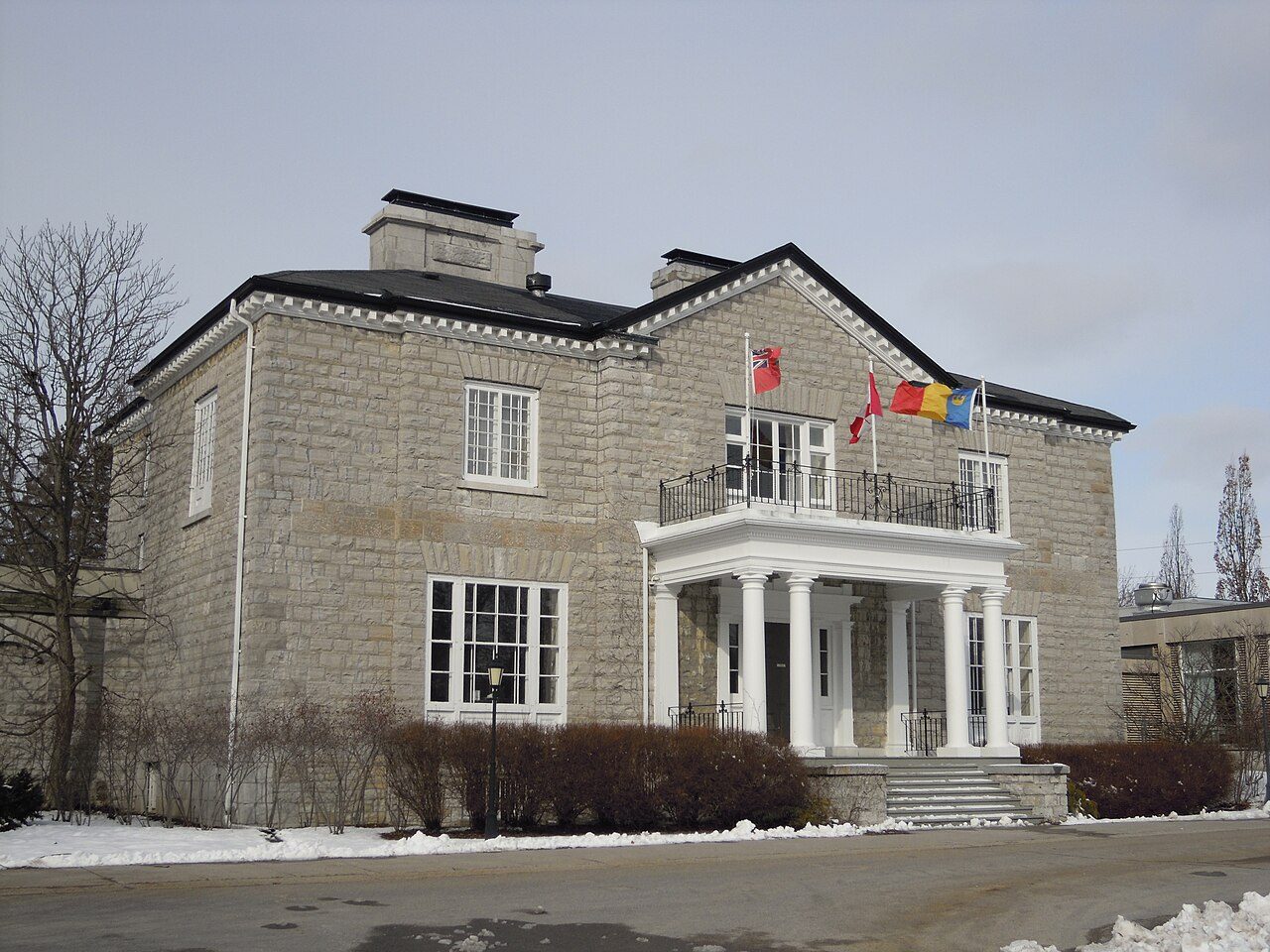
Roselawn National Historic Site of Canada is a two-storey Classical Revival house located in Kingston, Ontario. Once the centre of a grand estate, the house is situated within spacious landscaped grounds. This elegant, hip-roofed, limestone residence has a projecting frontispiece and a wide centrally placed gable over the main entrance. Classical details of this balanced design include an open porch with columns, dentillation at the eaves and symmetrically placed windows and chimneys. The designation refers to the original house and its grounds at the time of its designation in 1969.
From the Canadian Register of Historic Places, Roselawn National Historic Site of Canada · Open Government Licence – Canada · the register’s own words, unchanged
The Historic Sites and Monuments Board recommends National Historic Sites; the designation marks national significance, not ownership.
Finding Roselawn
Kingston


Its nearest historic neighbours are too far for a short walk.
Questions about Roselawn
Is Roselawn protected?
National Historic Site status commemorates; legal protection, where there is any, comes from the province or municipality, or from federal ownership.
Can you visit Roselawn?
From outside, yes; going in depends on who owns or runs it.
What is Roselawn?
Canada named Roselawn a National Historic Site in 1969.
When was Roselawn built?
Its register puts the building of Roselawn at 1841–1842.
Contains information licensed under the Open Government Licence – Canada (Parks Canada).
Sources: Parks Canada, Directory of Federal Heritage Designations · Canadian Register of Historic Places (federal extract) · Photos: Wikimedia Commons, each credited with its licence and copied to our own server · Wikidata (CC0) for map points, other names and articles.
Adapted from Statistics Canada (Census of Population 2021, population estimates 2025, 2021 census boundaries) under the Statistics Canada Open Licence; this does not constitute an endorsement by Statistics Canada. Neighbourhood names in some cities © OpenStreetMap contributors (ODbL).