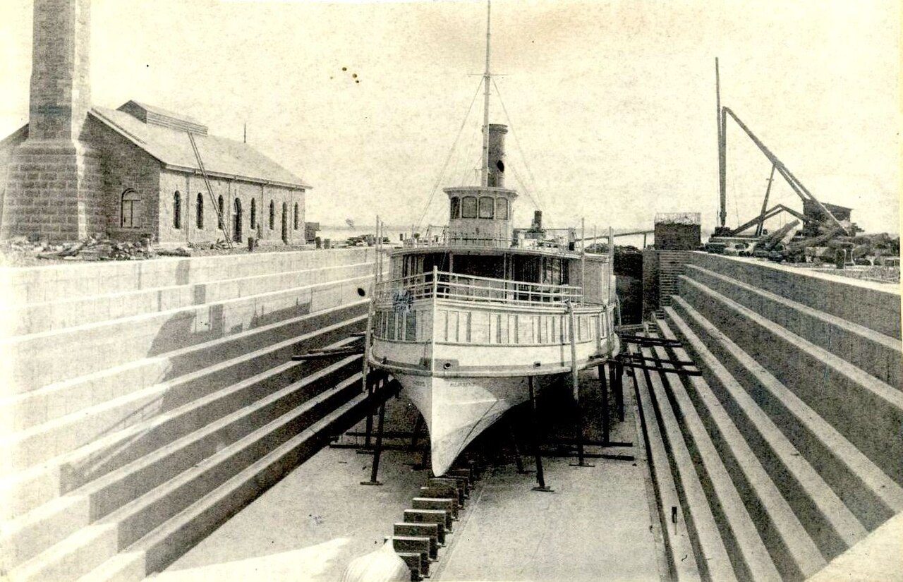
Kingston Dry Dock
In French: Musée maritime des Grands Lacs
Also known as Marine Museum of the Great Lakes
55 Ontario Street, Kingston
About Kingston Dry Dock
Kingston Dry Dock is one of 22 National Historic Sites in Kingston. By its record, Kingston Dry Dock was built in 1890–1893. Its makers on the record: Connolly and Company.
Kingston Dry Dock National Historic Site of Canada is located on Mississauga Point, part of the Kingston waterfront on the St. Lawrence River. It now forms part of the Marine Museum complex. The Kingston Dry Dock was an important repair facility for ships and provided dry working access to the exterior of a vessel below the waterline. The long, rectangular-shaped dock has stepped sides that rise 9.1 metres from its bed. The original dry dock had an inner invert width of 16.8 metres and a floor length of 85.3 metres. Both the walls and bed of the dock are constructed of limestone. The dock was subsequently lengthened to 115.2 metres using concrete. The dock gate or floating caisson is seated in a rectangular berth set at right angles to the dry dock entrance. The caisson is built of steel in the shape of a rectangular box with parallel sides and inclined ends.
From the Canadian Register of Historic Places, Kingston Dry Dock National Historic Site of Canada · Open Government Licence – Canada · the register’s own words, unchanged
The Historic Sites and Monuments Board recommends National Historic Sites; the designation marks national significance, not ownership.
Finding Kingston Dry Dock
Kingston


Nothing else on the registers lies within an easy stroll of it.
Questions about Kingston Dry Dock
Can you visit Kingston Dry Dock?
Yes, most likely: it is recorded as a museum, though hours vary.
What is Kingston Dry Dock?
A National Historic Site: Canada designated Kingston Dry Dock in 1978.
When was Kingston Dry Dock built?
The record of Kingston Dry Dock gives 1890–1893.
Is Kingston Dry Dock protected?
National Historic Site status commemorates; legal protection, where there is any, comes from the province or municipality, or from federal ownership.
Contains information licensed under the Open Government Licence – Canada (Parks Canada).
Sources: Parks Canada, Directory of Federal Heritage Designations · Canadian Register of Historic Places (federal extract) · Photos: Wikimedia Commons, each credited with its licence and copied to our own server · Wikidata (CC0) for map points, other names and articles.
Adapted from Statistics Canada (Census of Population 2021, population estimates 2025, 2021 census boundaries) under the Statistics Canada Open Licence; this does not constitute an endorsement by Statistics Canada. Neighbourhood names in some cities © OpenStreetMap contributors (ODbL).