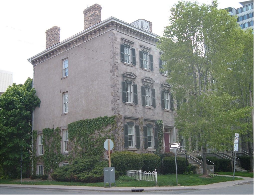
Sandyford Place
Also known as Sandyford Place
35-43 Duke Street, Durand
This may be someone’s home: look from the street and respect the owners.
About Sandyford Place
In Durand, Sandyford Place is one of 2 National Historic Sites. By its record, Sandyford Place was built in 1856–1857. Donald Nicholson designed it. Another historic place stands within 400 m of it.
Sandyford Place National Historic Site of Canada is a row of stone terrace houses, built in the mid-19th century. It is located on Duke Street in the Durand area, a primarily residential neighbourhood on the southern periphery of downtown Hamilton. The formal recognition consists of the row of four adjoining houses and the legal property on which they sat at the time of recognition.
From the Canadian Register of Historic Places, Sandyford Place National Historic Site of Canada · Open Government Licence – Canada · as published, word for word
A National Historic Site is designated by the federal minister on the Historic Sites and Monuments Board’s advice.
Make it a walk: 2 historic places in about 5 minutes
Durand · about 300 m on foot, as the crow flies


- 1Sandyford PlaceStart here
- 2McQuesten House / WhitehernNational Historic Site · 300 m on
Questions about Sandyford Place
What is Sandyford Place?
Sandyford Place has been a National Historic Site of Canada since 1975.
Is Sandyford Place protected?
National Historic Site status commemorates; legal protection, where there is any, comes from the province or municipality, or from federal ownership.
Can you visit Sandyford Place?
As a home it is probably lived in, so it is best seen from outside.
When was Sandyford Place built?
Work on Sandyford Place is recorded as 1856–1857.
Contains information licensed under the Open Government Licence – Canada (Parks Canada).
Sources: Parks Canada, Directory of Federal Heritage Designations · Canadian Register of Historic Places (federal extract) · Photos: Wikimedia Commons, each credited with its licence and copied to our own server · Wikidata (CC0) for map points, other names and articles.
Adapted from Statistics Canada (Census of Population 2021, population estimates 2025, 2021 census boundaries) under the Statistics Canada Open Licence; this does not constitute an endorsement by Statistics Canada. Neighbourhood names in some cities © OpenStreetMap contributors (ODbL).