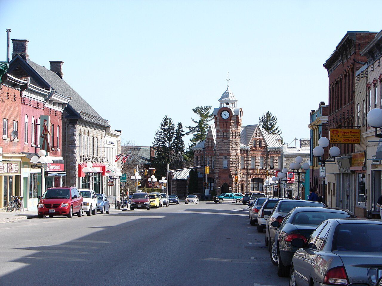
D.A. Gillies Building
In French: Édifice David A. Gillies
Also known as Arnprior and District Museum , Arnprior Post Office and Customs House , David A. Gillies Building
35 Madawaska Street, Arnprior
About D.A. Gillies Building
D.A. Gillies Building is the one National Historic Site in Arnprior. D.A. Gillies Building went up in 1896–1899. Dominion Chief Architect Thomas Fuller designed it.
The D.A. Gillies Building National Historic Site of Canada, a prominent local landmark, stands two-and-a-half-storeys tall, with a lively silhouette and roof line featuring an octagonal clock tower flanked by roughly symmetrical façades, each with a large gabled wall dormer. North of the main building is an original one-storey annex. The building’s walls comprise a colourful array of stone with arched openings, corbelling, stringcourses, and carved lettering. Constructed 1896 to 1898, it illustrates a late Victorian free-eclectic historical revival and picturesque design that includes the Richardsonian Romanesque and aspects of Gothic and Flemish design. The designated place is the footprint of the building.
From the Canadian Register of Historic Places, D.A. Gillies Building National Historic Site · Open Government Licence – Canada · as published, word for word
A National Historic Site is designated by the federal minister on the Historic Sites and Monuments Board’s advice.
Finding D.A. Gillies Building
Arnprior


There is no walk from here to another historic place; see farther afield.
Questions about D.A. Gillies Building
Can you visit D.A. Gillies Building?
As a museum it usually opens to the public; its operator sets the hours.
When was D.A. Gillies Building built?
By its record, D.A. Gillies Building dates from 1896–1899.
Is D.A. Gillies Building protected?
The designation recognizes its national significance; it doesn’t by itself protect a building the federal government doesn’t own. Provincial or municipal designation may.
What is D.A. Gillies Building?
D.A. Gillies Building is a National Historic Site of Canada, designated in 2024.
Contains information licensed under the Open Government Licence – Canada (Parks Canada).
Sources: Parks Canada, Directory of Federal Heritage Designations · Canadian Register of Historic Places (federal extract) · Photos: Wikimedia Commons, each credited with its licence and copied to our own server · Wikidata (CC0) for map points, other names and articles.
Adapted from Statistics Canada (Census of Population 2021, population estimates 2025, 2021 census boundaries) under the Statistics Canada Open Licence; this does not constitute an endorsement by Statistics Canada. Neighbourhood names in some cities © OpenStreetMap contributors (ODbL).