Africville
Africville Park, Windsor Park
About Africville
Canada counts Africville as Windsor Park’s National Historic Site. By its record, Africville was built in 1830.
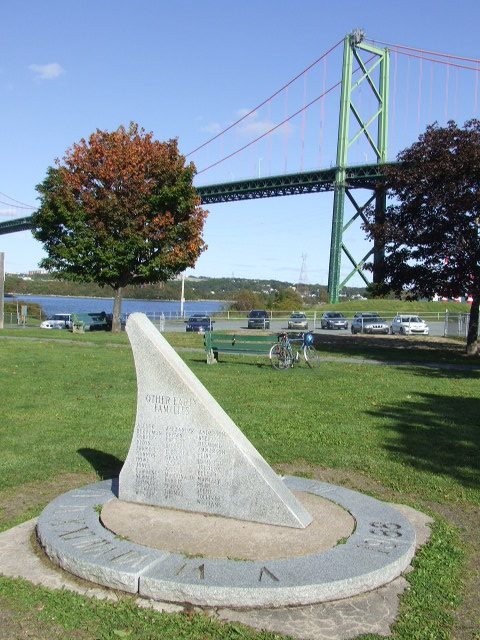
Africville National Historic Site of Canada is a site of remembrance for Halifax’s African Canadian community. Once the location of a historic Black community, the houses were demolished in the 1960s and the land converted into municipally owned Seaview Park. Located at the north end of Barrington Street on Bedford Basin, below the A. Murray MacKay Bridge, Africville is a symbol of African Canadian community organization and a site of pilgrimage for people honouring the struggle against racism. The open landscape is marked by a sundial-shaped monument commemorating the former community. The designation refers to the landscape and its associated resources, including a few foundation remnants.
From the Canadian Register of Historic Places, Africville National Historic Site of Canada · Open Government Licence – Canada · in the register’s words, not edited
National Historic Site status comes on the advice of the Historic Sites and Monuments Board of Canada.
Finding Africville
Windsor Park


No other historic place stands within a short walk; the town’s others are farther afield.
Questions about Africville
When was Africville built?
Africville went up in 1830, by its record.
Is Africville protected?
National Historic Site status commemorates; legal protection, where there is any, comes from the province or municipality, or from federal ownership.
What is Africville?
Africville became a National Historic Site in 1997.
Can you visit Africville?
Yes from the outside; whether it opens its doors is for its owner to say.
Contains information licensed under the Open Government Licence – Canada (Parks Canada).
Sources: Parks Canada, Directory of Federal Heritage Designations · Canadian Register of Historic Places (federal extract) · Photos: Wikimedia Commons, each credited with its licence and copied to our own server · Wikidata (CC0) for map points, other names and articles.
Adapted from Statistics Canada (Census of Population 2021, population estimates 2025, 2021 census boundaries) under the Statistics Canada Open Licence; this does not constitute an endorsement by Statistics Canada. Neighbourhood names in some cities © OpenStreetMap contributors (ODbL).