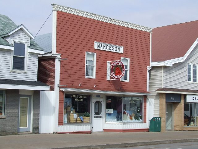
Apple Capital Museum
Apple Capital Museum is a municipal history museum in Berwick, Nova Scotia Canada. The one other place within 15 km is Oaklawn Farm Zoo, 9.7 km off. It has articles in 2 Wikipedias.
Museum in Berwick
Inside Berwick
Apple Capital Museum stands within Berwick’s municipal boundary. Towns near it ↓
Drawn from OpenStreetMap, Wikidata, ODCAF and the heritage registers, with Statistics Canada’s 2021 outlines and ECCC’s 1991–2020 normals.
Seasons and weather
If warmth matters, go May to September: Berwick reaches 17–26°C.
Apple Capital Museum
In Berwick, inside the town’s municipal boundary.
- Type
- Museum
- Wikipedias
- Covered in 2 languages
- Town
- in Berwick
- Official site
- berwickapplemuseum.wixsite.com/homepage
Entry, hours, address
Its place on the map
The map centres on Apple Capital Museum, in orange, with nearby places numbered.
© OpenStreetMap contributors · The dashed line is Berwick’s municipal boundary. · Statistics Canada 2021 outline
Which town is nearest
Of these 7 towns, the largest is Kingston (24,574 people). Closest first, each of these towns names it on its page.
- 1Berwick
- 2Kingston
- 3Kentville
- 4Kings County, Subdivision C
- 5Annapolis County, Subdivision C
- 6Kings County, Subdivision B
- 7Annapolis County, Subdivision D
Berwick
Kingston
Kentville
Kings County, Subdivision C
Compare the 7 towns
| Town | Where Apple Capital Museum is | People | Places to visit |
|---|---|---|---|
| Berwick | It’s in town | 2,631 | 1 |
| Kingston | 700 m southwest of it | 24,574 | 14 |
| Kentville | 19 km northeast of it | 7,589 | 4 |
| Kings County, Subdivision C | 20 km northeast of it | 8,994 | 6 |
| Annapolis County, Subdivision C | 24 km southwest of it | 5,694 | 14 |
| Kings County, Subdivision B | 25 km northeast of it | 12,661 | 13 |
| Annapolis County, Subdivision D | 42 km south of it | 3,273 | 14 |
Places to add to Apple Capital Museum
Around it, within 15 km, lies a zoo.
Within 15 km, close and well known first. Numbers match the map.
Questions before you go
Where is Apple Capital Museum?
Apple Capital Museum lies in Berwick, Nova Scotia, within the municipal boundary of the town.
What is Apple Capital Museum?
Municipal history museum in Berwick, Nova Scotia Canada.
How well known is Apple Capital Museum?
Wikipedia coverage puts Apple Capital Museum at #741 among Canadian places.
When is the best time to visit Apple Capital Museum?
Warmth peaks in Berwick from May to September, when afternoons reach 17–26°C (ECCC normals, 1991–2020).
Sources: © OpenStreetMap contributors (ODbL), Wikidata (CC0), Statistics Canada’s ODCAF (Open Government Licence – Canada), the federal and Québec heritage registers, Statistics Canada 2021 census boundaries, ECCC 1991–2020 climate normals (Open Government Licence – Canada).
Photos: each place’s Wikidata image, from Wikimedia Commons under the licence below (our copy, resized).
Photo credits (1)
- Apple Capital Museum: Letterofmarque, Public domain, Wikimedia Commons
Adapted from Statistics Canada (Census of Population 2021, population estimates 2025, 2021 census boundaries) under the Statistics Canada Open Licence; this does not constitute an endorsement by Statistics Canada. Neighbourhood names in some cities © OpenStreetMap contributors (ODbL).