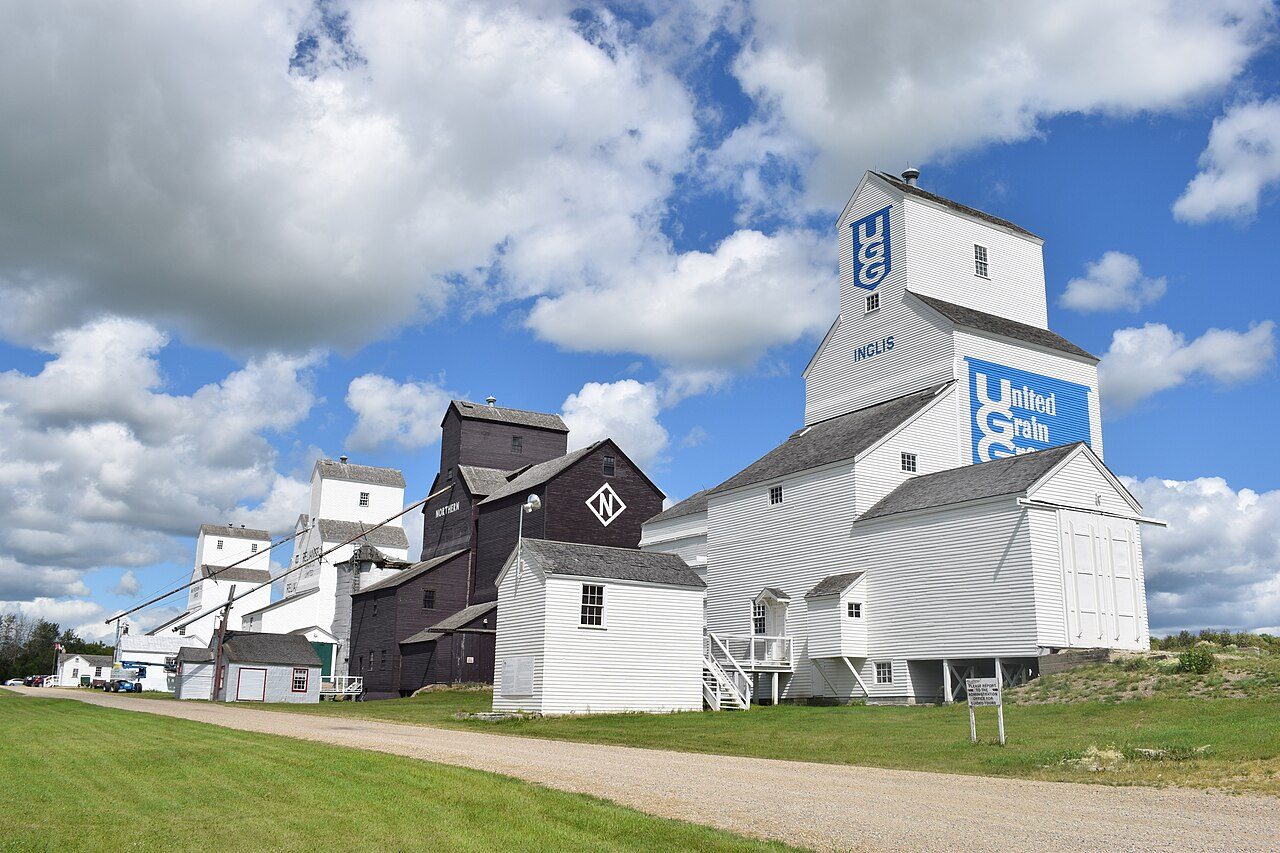
Inglis Grain Elevators
In French: Élévateurs à grains d'Inglis
About Inglis Grain Elevators
Inglis Grain Elevators is the one National Historic Site in Riding Mountain West. Inglis Grain Elevators went up in 1922–1942.
In the small town of Inglis, Manitoba, a row of tall wooden elevators are lined up parallel to the railway tracks. This is the Inglis Grain Elevators National Historic Site of Canada - a rare surviving icon of prairie towns during the “golden age of grain.” The elevators, no longer in active use, are preserved as a historic site. The designation refers to the elevators, their associated buildings and stretch of railway track.
From the Canadian Register of Historic Places, Inglis Grain Elevators National Historic Site of Canada · Open Government Licence – Canada · quoted as the register has it
National Historic Sites are places the Minister of Environment designates, on the advice of the Historic Sites and Monuments Board, for their national significance.
Finding Inglis Grain Elevators
Riding Mountain West


Its nearest historic neighbours are too far for a short walk.
Questions about Inglis Grain Elevators
Is Inglis Grain Elevators protected?
The designation recognizes its national significance; it doesn’t by itself protect a building the federal government doesn’t own. Provincial or municipal designation may.
Can you visit Inglis Grain Elevators?
Yes, most likely: it is recorded as a museum, though hours vary.
What is Inglis Grain Elevators?
Inglis Grain Elevators is a National Historic Site of Canada, designated in 1995.
When was Inglis Grain Elevators built?
Work on Inglis Grain Elevators is recorded as 1922–1942.
Contains information licensed under the Open Government Licence – Canada (Parks Canada).
Sources: Parks Canada, Directory of Federal Heritage Designations · Canadian Register of Historic Places (federal extract) · Photos: Wikimedia Commons, each credited with its licence and copied to our own server · Wikidata (CC0) for map points, other names and articles.
Adapted from Statistics Canada (Census of Population 2021, population estimates 2025, 2021 census boundaries) under the Statistics Canada Open Licence; this does not constitute an endorsement by Statistics Canada. Neighbourhood names in some cities © OpenStreetMap contributors (ODbL).