Lookout Mountain
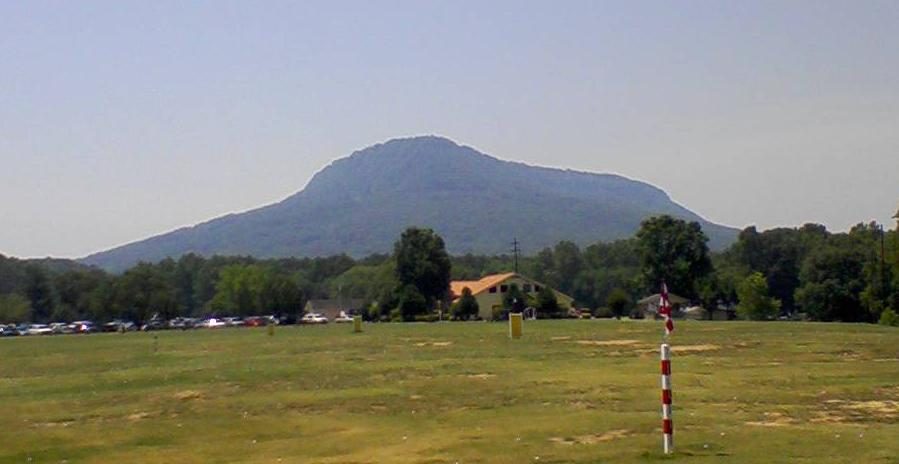
Lookout Mountain is a mountain ridge at the northwest corner of the U.S. state of Georgia, the northeast corner of Alabama, and along the southeastern Tennessee state line. Its location is 4 mi southeast of West Brow. A drive of 11 mi reaches Ruby Falls.

A mountain, 4 mi southeast of West Brow
New England is the nearest base
New England is 6 miles northwest, with 5 places to stay. Where to stay ↓
A day trip from Atlanta
Atlanta is about 94 miles southeast (straight-line). Where to stay ↓
Best months: Apr, May, Jun, Sep and Oct
April, May, June, September and October are the mild months, with highs of 69–83°. When to go ↓
Written from NOAA 1991–2020 normals, Overture places to stay, Census town figures, Wikidata and Wikipedia.
Month by month
Here is how the weather at Lookout Mountain changes month by month.
Lookout Mountain
Lookout Mountain is a mountain ridge at the northwest corner of the U.S. state of Georgia, the northeast corner of Alabama, and along the southeastern Tennessee state line in Chattanooga. Lookout Mountain was the scene of the 18th-century "Last Battle of the Cherokees" in this area during the Nickajack Expedition. On November 24, 1863, during the American Civil War, the Battle of Lookout Mountain took place here.
- Type
- Mountain
- Elevation
- 2,392 ft
- Wikipedia readers
- 47K a year
Nights near Lookout Mountain
Hotels, motels or campgrounds are closest in Chattanooga (157) and East Ridge (28).
- 1Ruby Falls
- 2Ellison's Cave
- 3Lake Winnepesaukah
- 4Cloudland Canyon
- 5Nickajack Cave
- 6Tennessee Aquarium
- 7Chickamauga and Chattanooga
- 8Tennessee Valley Railroad Museum
Chattanooga
The closest town with somewhere to stay.
194,144 people
16 mi northeast of Lookout Mountain
Compare 8 towns
| Town | From Lookout Mountain | Drive | Places to stay | People | Typical home | Safety |
|---|---|---|---|---|---|---|
| Chattanooga | 16 mi northeast | 25 min | 157 124 hotels · 12 motels · 7 inns & B&Bs · 6 lodges & cabins · 3 hostels · 3 campgrounds · 2 RV parks | 194,144 | $283K | D− |
| East Ridge | 13 mi northeast | 20 min | 28 20 hotels · 3 motels · 1 inn or B&B · 2 campgrounds · 2 RV parks | 21,921 | $211K | C− |
| Trenton | 7 mi west | 10 min | 9 2 hotels · 1 motel · 2 lodges & cabins · 1 campground · 3 RV parks | 2,236 | $166K | — |
| New England | 6 mi northwest | 10 min | 5 2 hotels · 2 campgrounds · 1 RV park | 391 | — | — |
| West Brow | 4 mi northwest | 5 min | 4 3 hotels · 1 campground | 1,044 | $279K | — |
| Ringgold | 16 mi east | 25 min | 10 8 hotels · 1 motel · 1 RV park | 3,391 | $243K | — |
| Indian Springs | 15 mi northeast | 20 min | 8 1 hotel · 1 lodge or cabins · 5 campgrounds · 1 RV park | 2,070 | $235K | — |
| Dalton | 25 mi east | 35 min | 27 24 hotels · 1 motel · 2 lodges & cabins | 35,322 | $222K | C |
Day trip from
Straight-line miles.
Getting there
Nearest airports with airline service
Combine it with these
These well-known places are within 18 miles.
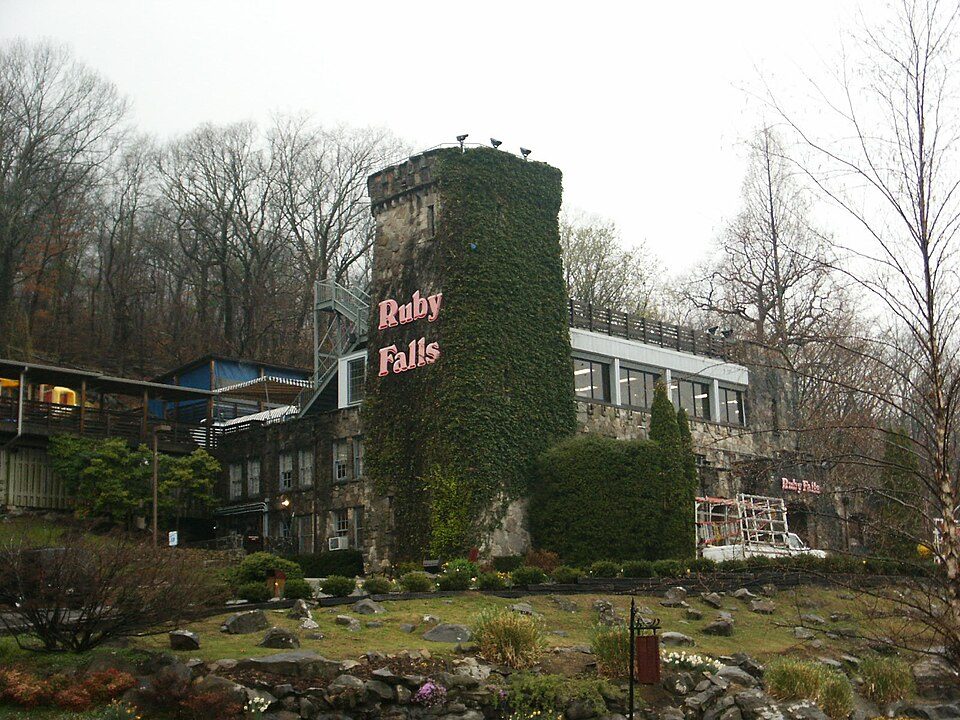 111 mi WaterfallRuby Falls214 mi CaveEllison's Cave311 mi Theme parkLake Winnepesaukah
 45 mi State parkCloudland Canyon State Park
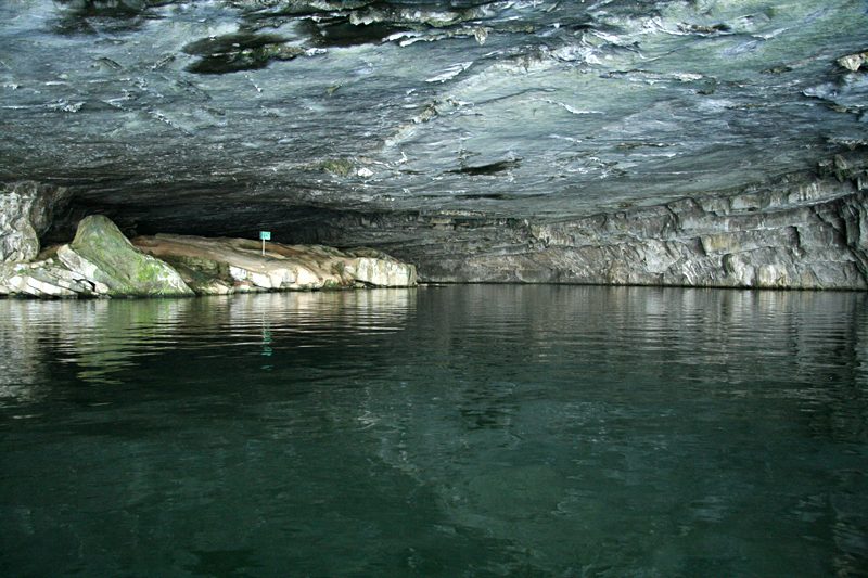 515 mi Park & preserveNickajack Cave
 614 mi Zoo & aquariumTennessee Aquarium
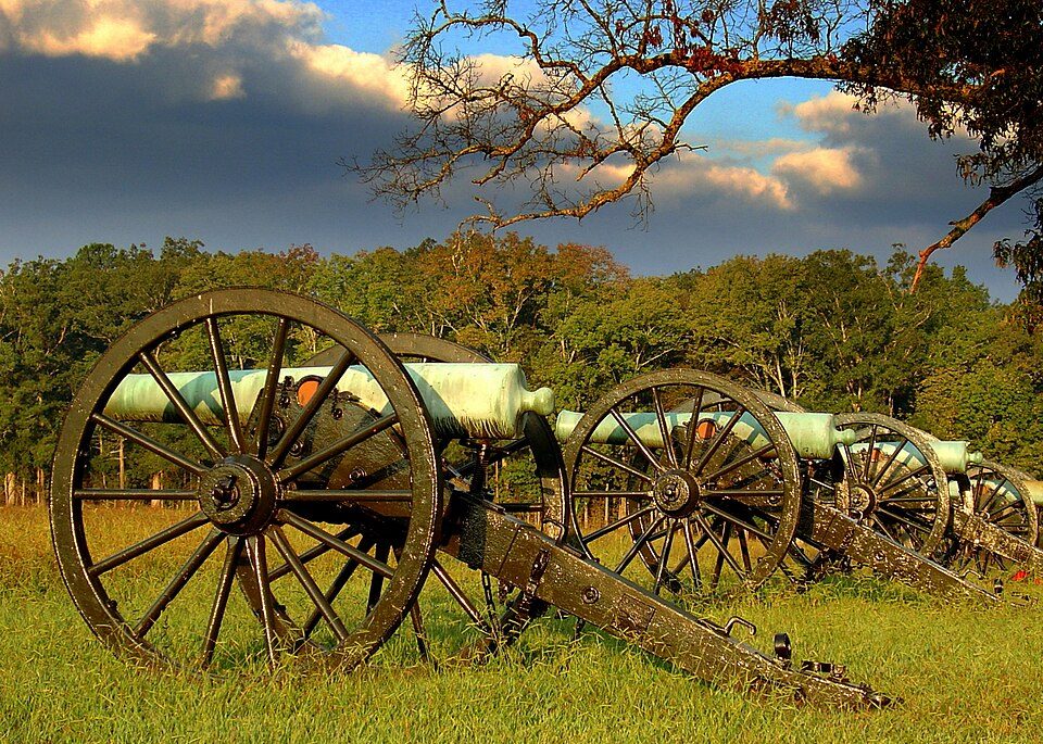 79 mi National Military ParkChickamauga and Chattanooga National Military Park972K visitors a year
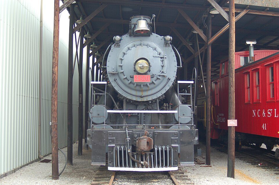 818 mi MuseumTennessee Valley Railroad Museum
Photo credits
Ruby Falls: Oydman (talk), CC BY-SA 3.0 · Cloudland Canyon State Park: Ronmacal at English Wikipedia, Public domain · Nickajack Cave: Blueway, CC BY-SA 3.0 · Tennessee Aquarium: Ɱ, CC BY-SA 4.0 · Chickamauga and Chattanooga National Military Park: Lhughesw5, CC BY-SA 3.0 · Tennessee Valley Railroad Museum: TVSRR at English Wikipedia. Photo by Jason Trew /TVSRR, Public domain


Before visiting Lookout Mountain
What town is Lookout Mountain near?
West Brow, GA, about 4 miles northwest.
When is the best time to visit Lookout Mountain?
April, May, June, September and October, with highs of 69–83°.
How far is Lookout Mountain from Atlanta?
About 94 miles southeast of Atlanta, as the crow flies.
What is the closest airport to Lookout Mountain?
Chattanooga Metropolitan Airport (Lovell Field) (CHA), about 16 miles away. The nearest big hub is Hartsfield Jackson Atlanta (ATL), about 101 miles.
Where should I stay near Lookout Mountain?
Chattanooga (16 mi, 157 places to stay), East Ridge (13 mi, 28 places to stay) and Trenton (7 mi, 9 places to stay).
Locals’ advice in West Brow
Share what you know in West Brow’s Town Square.
Sources: National Park Service · ski areas © OpenSkiMap / OpenStreetMap contributors · Wikidata · Wikipedia readership · NOAA climate normals · U.S. Census.