
Lewis and Clark National Historic Trail
The Lewis and Clark National Historic Trail is a route across the United States commemorating the Lewis and Clark Expedition of 1804 to 1806.

A park & preserve, 22 mi northeast of Lockwood
Plan where you’ll sleep
The nearest town with many places to stay is Hardin, 26 miles southeast. Where to stay ↓
Winters are cold
January nights drop to 15°, with about 35" of snow a year. When to go ↓
Best months: May, Jun and Sep
May, June and September are the mild months, with highs of 68–78°. When to go ↓
Established in 1978
Lewis and Clark National Historic Trail dates from 1978 and is run by National Park Service. About ↓
Written from NOAA 1991–2020 normals, Overture places to stay, Census town figures, Wikidata and Wikipedia.
Weather, month by month
Typical highs and lows in Lockwood. Green months are the mild ones.
Lewis and Clark National Historic Trail
The Lewis and Clark National Historic Trail is a route across the United States commemorating the Lewis and Clark Expedition of 1804 to 1806. It is part of the National Trails System of the United States. It extends for some 4,900 miles (7,900 km) from Pittsburgh, Pennsylvania, to the mouth of the Columbia River near present-day Astoria, Oregon. It was originally established in 1978 as a 3,700-mile (6,000 km) trail following the historic outbound and inbound routes of the Lewis and Clark Expedition from Camp Dubois at Wood River, Illinois, to Oregon. In 2019, the trail was extended east to follow the expedition's 1803 preparatory journey from Pittsburgh to Wood River. The trail connects 16 states (Pennsylvania, Ohio, West Virginia, Kentucky, Indiana, Illinois, Missouri, Kansas, Nebraska, Iowa, South Dakota, North Dakota, Montana, Idaho, Washington, and Oregon) and many tribal lands.
- Type
- Park & preserve
- Established
- 1978
- Area
- 79,537 square miles
- Run by
- National Park Service
- Wikipedia readers
- 24K a year
Where to stay near Lewis and Clark National Historic Trail
The closest towns with hotels, motels or campgrounds are Billings (87) and Hardin (10).
Billings
The closest town with somewhere to stay.
121,239 people
30 mi southwest of Lewis and Clark National Historic Trail
Compare 3 towns
| Town | From Lewis and Clark National Historic Trail | Drive | Places to stay | People | Typical home | Safety |
|---|---|---|---|---|---|---|
| Billings | 30 mi southwest | 45 min | 87 69 hotels · 9 motels · 2 inns & B&Bs · 6 lodges & cabins · 1 RV park | 121,239 | $343K | D |
| Hardin | 26 mi southeast | 40 min | 10 4 hotels · 2 motels · 1 inn or B&B · 1 lodge or cabins · 2 campgrounds | 3,696 | $147K | C |
| Lockwood | 22 mi southwest | 35 min | 3 2 hotels · 1 lodge or cabins | 7,181 | $235K | — |
Getting there
Nearest airports with airline service
Also near Lewis and Clark National Historic Trail
Other well-known places within 64 miles. Numbered ones are on the map above.
 1in town Park & preservePompeys Pillar National Monument
 41 mi National MonumentLittle Bighorn Battlefield National Monument42K visitors a year
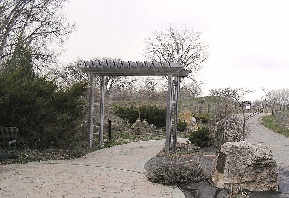 35 mi Zoo & aquariumZooMontana
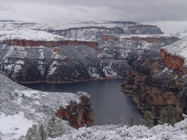 64 mi National Recreation AreaBighorn Canyon National Recreation Area228K visitors a year
 228 mi MuseumYellowstone Art Museum
 328 mi MuseumWestern Heritage Center
Photo credits
Pompeys Pillar National Monument: BLM photo, Public domain · Little Bighorn Battlefield National Monument: 1025wil, CC BY-SA 3.0 · ZooMontana: Montanabw, CC BY-SA 3.0 · Bighorn Canyon National Recreation Area: National Park Service, Bighorn Canyon National Recreation Area, Public domain · Yellowstone Art Museum: Clyde Charles Brown, CC BY-SA 4.0 · Western Heritage Center: Unknown authorUnknown author, Public domain


Visiting Lewis and Clark National Historic Trail
What town is Lewis and Clark National Historic Trail near?
Lockwood, MT, about 22 miles southwest.
When is the best time to visit Lewis and Clark National Historic Trail?
May, June and September, with highs of 68–78°.
What is the closest airport to Lewis and Clark National Historic Trail?
Billings Logan (BIL), about 29 miles away.
Where should I stay near Lewis and Clark National Historic Trail?
Billings (30 mi, 87 places to stay), Hardin (26 mi, 10 places to stay) and Lockwood (22 mi, 3 places to stay).
Tips from people in Lockwood
No tips yet. Ask, or answer, in Lockwood’s Town Square.
Sources: National Park Service · ski areas © OpenSkiMap / OpenStreetMap contributors · Wikidata · Wikipedia readership · NOAA climate normals · U.S. Census.