
Fort Larned National Historic Site
Fort Larned National Historic Site preserves Fort Larned which operated from 1859 to 1878.

A national historic site, 6 mi west of Larned
Visits fell 22% in 2025
The National Park Service counted 20,576 visitors in 2025, down from 26,219 the year before. Visitors ↓
Summers are hot
July highs run 92–92°, and about 79 days a year reach 90°. When to go ↓
Winters are cold
January nights drop to 20°. When to go ↓
Larned is the nearest base
Larned is 6 miles east, with 5 places to stay. Where to stay ↓
Best month: Oct
October is mild and quieter than average, with a high of 70°. When to go ↓
Written from National Park Service visitor counts, NOAA 1991–2020 normals, Overture places to stay, Census town figures, Wikidata and Wikipedia. Updated when the Park Service posts a new month.
Crowds and weather, month by month
Bars: average monthly visitors, 2022–2025. Line: the typical afternoon high. Green months are mild and quieter than average.
Fort Larned National Historic Site
Fort Larned National Historic Site preserves Fort Larned which operated from 1859 to 1878. It is approximately 5.5 miles (8.9 km) west of Larned, Kansas, United States.
- Type
- National Historic Site
- Run by
- National Park Service
- Listed
- National Historic Landmark (1960) · National Register of Historic Places (1966) · listed on the Register of Historic Kansas Places (1977)
- Wikipedia readers
- 5.5K a year
- Official site
- nps.gov/fols
Before you go
Where to stay near Fort Larned National Historic Site
The closest towns with hotels, motels or campgrounds are Larned (5) and Great Bend (13).
Larned
The closest town with somewhere to stay.
3,596 people
6 mi east of Fort Larned Visitor Center · 6 mi to the park
Great Bend
14,266 people
26 mi northeast of Fort Larned Visitor Center · 25 mi to the park
Compare 8 towns
| Town | From the visitor center | Drive | Places to stay | People | Typical home | Safety |
|---|---|---|---|---|---|---|
| Larned | 6 mi east | 10 min | 5 3 hotels · 1 motel · 1 RV park | 3,596 | $95K | C |
| Great Bend | 26 mi northeast | 40 min | 13 11 hotels · 1 lodge or cabins · 1 RV park | 14,266 | $134K | C |
| Kinsley | 21 mi southwest | 30 min | 4 1 inn or B&B · 2 lodges & cabins · 1 RV park | 1,312 | $68K | — |
| La Crosse | 25 mi north | 35 min | 1 1 motel | 1,225 | $85K | — |
| Marena Township | 25 mi west | 40 min | 1 1 inn or B&B | 381 | $94K | — |
| La Crosse-Brookdale Township | 26 mi north | 40 min | 1 1 motel | 1,304 | $86K | — |
| South Bend Township | 27 mi east | 40 min | 1 1 lodge or cabins | 563 | $116K | — |
| Hanston | 27 mi west | 40 min | 1 1 inn or B&B | 240 | $93K | — |
Getting there
Nearest airports with airline service, from the visitor center
Also near Fort Larned
Other well-known places within 52 miles. Numbered ones are on the map above.
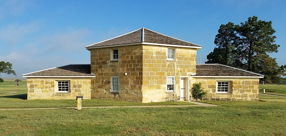 49 mi LandmarkFort Hays
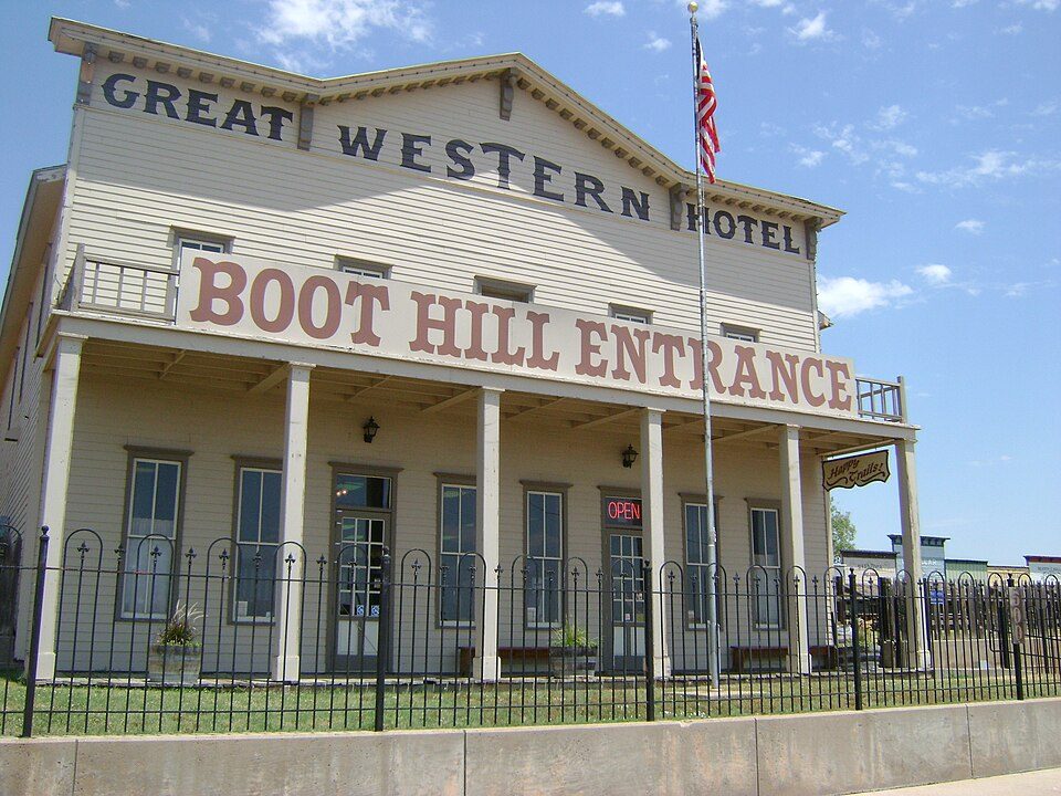 52 mi MuseumBoot Hill Museum129 mi Zoo & aquariumGreat Bend Zoo
 51 mi MuseumSternberg Museum of Natural History
Photo credits
Fort Hays: IveGoneAway, CC BY-SA 4.0 · Boot Hill Museum: Lithistman, CC BY-SA 3.0 · Sternberg Museum of Natural History: FUBAR007, CC0


20,576 visitors in 2025
Every full year the Park Service has counted. 2020 (gold) was the pandemic year. Green is the record (2016).
Visiting Fort Larned
What town is Fort Larned National Historic Site near?
Larned, KS, about 6 miles east.
When is the best time to visit Fort Larned National Historic Site?
October, with a high of 70°. May is the busiest month (about 3,653 visitors).
How many people visit Fort Larned National Historic Site each year?
20,576 in 2025, according to the National Park Service. The record is 31,060, set in 2016.
What is the closest airport to Fort Larned National Historic Site?
Hays Regional (HYS), about 46 miles away. The nearest big hub is OKC Will Rogers World (OKC), about 213 miles.
Where should I stay near Fort Larned National Historic Site?
Larned (6 mi, 5 places to stay), Great Bend (26 mi, 13 places to stay) and Kinsley (21 mi, 4 places to stay).
Tips from people in Larned
No tips yet. Ask, or answer, in Larned’s Town Square.
Sources: National Park Service · ski areas © OpenSkiMap / OpenStreetMap contributors · Wikidata · Wikipedia readership · National Park Service visitor use statistics · NOAA climate normals · U.S. Census.