
Dry Falls
Dry Falls is a 3.5-mile-long (5.6 km) scalloped precipice with four major alcoves, in central Washington scablands.

A waterfall, 3 mi west of Coulee City
Plan where you’ll sleep
The nearest town with many places to stay is Soap Lake, 16 miles south. Where to stay ↓
Best months: May, Jun and Sep
May, June and September are the mild months, with highs of 72–79°. When to go ↓
Written from NOAA 1991–2020 normals, Overture places to stay, Census town figures, Wikidata and Wikipedia.
Weather, month by month
Typical highs and lows in Coulee City. Green months are the mild ones.
Dry Falls
Dry Falls is a 3.5-mile-long (5.6 km) scalloped precipice with four major alcoves, in central Washington scablands. This cataract complex is on the opposite side of the Upper Grand Coulee from the Columbia River, and at the head of the Lower Grand Coulee, northern end of Lenore Canyon. According to the current geological model, catastrophic flooding channeled water at 65 miles per hour (105 kph) through the Upper Grand Coulee and over this 400-foot (120 m) rock face at the end of the last glaciation. It is estimated that the falls were five times the width of Niagara Falls, with ten times the flow of all the current rivers in the world combined.
- Type
- Waterfall
- Elevation
- 1,509 ft
- Wikipedia readers
- 26K a year
Where to stay near Dry Falls
The closest towns with hotels, motels or campgrounds are Coulee City (3) and Soap Lake (5).
Compare 6 towns
| Town | From Dry Falls | Drive | Places to stay | People | Typical home | Safety |
|---|---|---|---|---|---|---|
| Coulee City | 3 mi east | 5 min | 3 1 hotel · 1 lodge or cabins · 1 campground | 550 | $166K | — |
| Banks Lake South | 4 mi northeast | 5 min | 2 1 motel · 1 RV park | 348 | $252K | — |
| Soap Lake | 16 mi south | 25 min | 5 2 hotels · 1 motel · 1 lodge or cabins · 1 RV park | 1,817 | $250K | C |
| Ephrata | 22 mi southwest | 35 min | 7 3 hotels · 2 motels · 1 inn or B&B · 1 RV park | 8,834 | $252K | C− |
| Grand Coulee | 28 mi northeast | 40 min | 6 2 motels · 1 lodge or cabins · 1 campground · 2 RV parks | 947 | $222K | — |
| Electric City | 26 mi northeast | 40 min | 2 1 motel · 1 RV park | 954 | $198K | — |
Getting there
Nearest airports with airline service
Also near Dry Falls
Other well-known places within 64 miles. Numbered ones are on the map above.
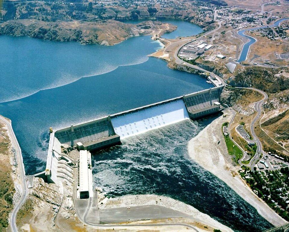 Big draw130 mi DamGrand Coulee Dam
 22 mi Park & preserveGrand Coulee
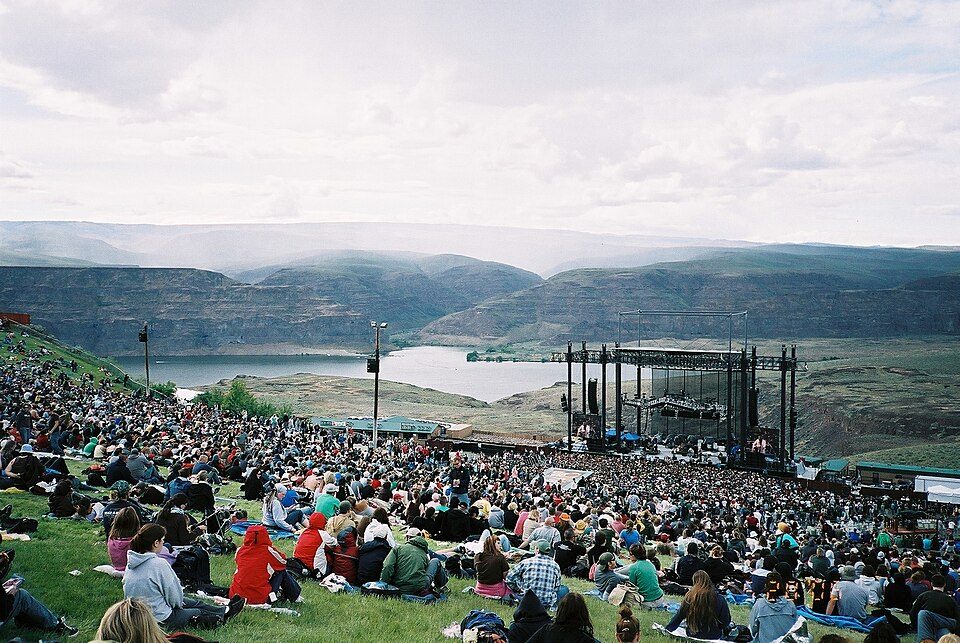 46 mi TheatreThe Gorge Amphitheatre
 36 mi LakeLake Chelan
 55 mi State parkGinkgo Petrified Forest State Park54 mi Ski areaMission Ridge54 runs · 2,181 ft vertical
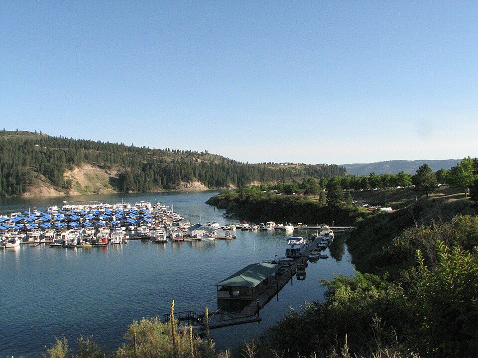 63 mi National Recreation AreaLake Roosevelt National Recreation Area1.2M visitors a year60 mi Ski areaLoup Loup Ski Bowl19 runs · 1,226 ft vertical
Photo credits
Grand Coulee Dam: U.S. Bureau of Reclamation, Public domain · Grand Coulee: en:User:Duk, CC BY-SA 3.0 · The Gorge Amphitheatre: Daniel from Calgary, Canada, CC BY 2.0 · Lake Chelan: David Ansley, CC BY 2.5 · Ginkgo Petrified Forest State Park: No machine-readable author provided. Justinleif~commonswiki assumed (based on co, Public domain · Lake Roosevelt National Recreation Area: Karyn Christner, CC BY 2.0


Visiting Dry Falls
What town is Dry Falls near?
Coulee City, WA, about 3 miles east.
When is the best time to visit Dry Falls?
May, June and September, with highs of 72–79°.
What is the closest airport to Dry Falls?
Pangborn Memorial (EAT), about 42 miles away. The nearest big hub is Spokane (GEG), about 85 miles.
Where should I stay near Dry Falls?
Coulee City (3 mi, 3 places to stay), Soap Lake (16 mi, 5 places to stay) and Ephrata (22 mi, 7 places to stay).
Tips from people in Coulee City
No tips yet. Ask, or answer, in Coulee City’s Town Square.
Sources: National Park Service · ski areas © OpenSkiMap / OpenStreetMap contributors · Wikidata · Wikipedia readership · NOAA climate normals · U.S. Census.