
Caernarfon
In Caernarfon stands Caernarfon, a fort. Add any of 7 more places within 5 km to a visit. The register lists it as a National Monument of Wales.
Fort in Caernarfon
One of the best-known places to visit in England, Scotland, Wales and Northern Ireland
#24 of the 8,556 museums, castles, gardens and other attractions we list, by how widely it is covered (54 Wikipedias). About ↓
Inside Caernarfon
Caernarfon is inside Caernarfon’s built-up area, with 7 more places to visit within 5 km. Towns near it ↓
National Monument of Wales
On the official list of protected heritage; Caernarfon has 250 listed buildings in all, on its History page. About ↓
Written from OpenStreetMap, Wikidata, the ONS built-up areas and Met Office 1991–2020 averages.
Which month to go
Highs of 18–20°C mark June to September in Caernarfon.
Caernarfon
It is written up in 54 Wikipedias. For a second stop, Castell Caernarfon is 500 m away.
- Type
- Fort
- Listed
- National Monument of Wales
- Wikipedias
- Covered in 54 languages
- Town
- in Caernarfon
- Official site
- caernarfononline.co.uk
Where Caernarfon is
Caernarfon sits at the orange dot; the numbered ones are listed below.
© OpenStreetMap contributors · The dashed line is Caernarfon’s built-up area. · ONS built-up area 2022
Towns that list Caernarfon
Caernarfon is the biggest of the 8 bases nearby (9,831 people). Nearest first, every town here counts it among its places to visit.
Caernarfon
Caeathro
Bontnewydd
Brynsiencyn
Compare the 8 towns
| Town | Where Caernarfon is | People | Places to visit |
|---|---|---|---|
| Caernarfon | It’s in town | 9,831 | 14 |
| Caeathro | 1.6 km southeast of it | 248 | 8 |
| Bontnewydd | 2.2 km south of it | 821 | 11 |
| Brynsiencyn | 4 km north of it | 655 | 14 |
| Dwyran | 4.1 km northwest of it | 700 | 12 |
| Bethel | 4.4 km northeast of it | 1,091 | 11 |
| Waunfawr | 4.5 km southeast of it | 928 | 8 |
| Rhostryfan | 4.7 km south of it | 308 | 9 |
Close to Caernarfon
A visit can add 3 castles, 2 museums and a fort, from 37 places within 15 km.
 Castle · CadwCastell Caernarfon500 m away2
 Fort · CadwCaernarfon Town Walls600 m away3CastleCastle · CadwCastell Dolbadarn11 km away4
 CastleCaer y Belan4.6 km away5
 CathedralBangor Cathedral14 km away6
 AquariumAnglesey Sea Zoo2.7 km away7
 MuseumRoyal Welch Fusiliers Museum500 m away8
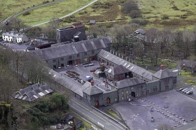 MuseumWelsh Slate Museum11 km away
Within 15 km, close and well known first. Numbers match the map.
Caernarfon: what to know
Where is Caernarfon?
Caernarfon is in Caernarfon, Gwynedd, inside the town’s built-up area.
What is Caernarfon?
Town in Gwynedd, Wales.
When is the best time to visit Caernarfon?
June to September are the warmest months in Caernarfon, with afternoon highs of 18–20°C (Met Office 1991–2020 averages).
Is Caernarfon a listed building?
Yes: National Monument of Wales.
What else is there to see near Caernarfon?
Within 15 km: Castell Caernarfon (500 m), Caernarfon Town Walls (600 m), Castell Dolbadarn (11 km) and Caer y Belan (4.6 km).
Places: OpenStreetMap (© OpenStreetMap contributors, Open Database Licence) and Wikidata (CC0), placed in the ONS 2022 built-up area (Open Government Licence v3.0). Visitor counts are the latest Wikidata gives, with their year.
Photos: each place’s Wikidata image, from Wikimedia Commons under the licence below (our copy, resized).
Photo credits (8)
- Caernarfon: Nilfanion, CC BY-SA 4.0, Wikimedia Commons
- Castell Caernarfon: Llywelyn2000, CC BY-SA 4.0, Wikimedia Commons
- Caernarfon Town Walls: Philip Halling, CC BY-SA 2.0, Wikimedia Commons
- Caer y Belan: Phyllis Flannagan, CC BY-SA 2.0, Wikimedia Commons
- Bangor Cathedral: Denis Egan from Bangor, Gwynedd, North Wales, CC BY 2.0, Wikimedia Commons
- Anglesey Sea Zoo: Lynne Kirton, CC BY-SA 2.0, Wikimedia Commons
- Royal Welch Fusiliers Museum: Alan Fryer, CC BY-SA 2.0, Wikimedia Commons
- Welsh Slate Museum: Talsarnau Times, CC BY-SA 4.0, Wikimedia Commons
Contains public sector information licensed under the Open Government Licence v3.0. Contains HM Land Registry data © Crown copyright and database right 2026. Contains OS data © Crown copyright and database right 2026 (ONS boundaries). Northern Ireland: Source: NISRA; contains Land & Property Services data and Ordnance Survey of Northern Ireland information, © Crown copyright, licensed under the Open Government Licence v3.0. Scotland: contains National Records of Scotland data, Registers of Scotland data and SEPA data, © Crown copyright / © SEPA 2025, licensed under the Open Government Licence v3.0.